
by CoastView | Dec 27, 2024 | 2024, Alaska, Biodiversity, Canneries, Coastal Features, Communities, Developments, Embayments, Hatcheries, Historical, Islands, Land Use, Rivers
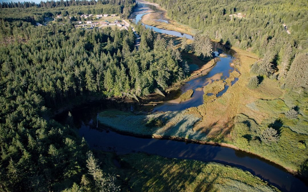
Loring is a small community at the site of a historical salmon cannery on the west coast of Revillagigedo Island, at the head of Naha Bay and near the mouth of the Naha River, about 66 miles (106 km) south-southeast of Wrangell and 17 miles (27 km) north of Ketchikan,...
by CoastView | Dec 25, 2024 | 2024, Alaska, Biodiversity, Climate Change, Coastal Features, Embayments, Glaciers, Land Use, Parks, Rivers
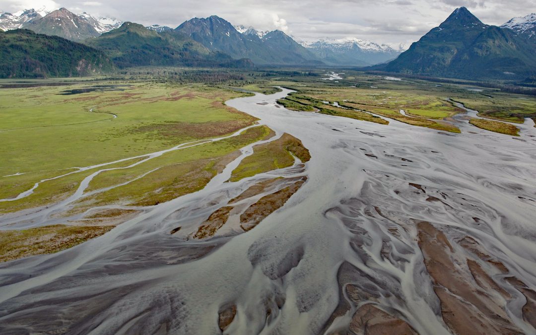
West Glacier Creek flows generally south-southeast for about 7 miles (11 km) to the north shore of Chinitna Bay, draining a watershed between the Chigmit Mountains and Mount Iliamna, about 83 miles (134 km) southwest of Kenai and 60 miles (97 km) west-northwest of...
by CoastView | Dec 22, 2024 | 2024, Biodiversity, British Columbia, Coastal Features, Communities, Embayments, Historical, Land Use, Rivers
Anacla is a community of the Huu-ay-aht First Nation on the Pachena River near the head of Pachena Bay, about 37 miles (60 km) northwest of Port Renfrew and 2.4 miles (4 km) south-southwest of Bamfield, British Columbia. The Huu-ay-aht are part of the larger culture...

by CoastView | Dec 18, 2024 | 2024, Alaska, Biodiversity, Climate Change, Coastal Features, Embayments, Glaciers, Historical, Land Use, Parks, Rivers
Beartrack Cove is an estuary about 3 miles (4.8 km) long and 1.6 miles (2.6 km) wide situated at the mouth of the Beartrack River in Glacier Bay National Park and Preserve, about 46 miles (74 km) south-southwest of Haines and 14 miles (23 km) north-northwest of...
by CoastView | Dec 15, 2024 | 2024, Alaska, Climate Change, Coastal Features, Embayments, Freshwater, Glaciers, Historical, Land Use, Nitrogen Cycle, Rivers, Waterfalls
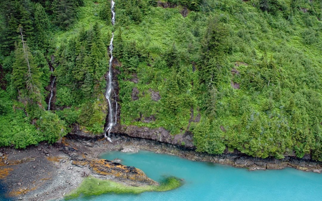
Ultramarine Glacier is located at the head of Blue Fjord, a glacial estuary that trends generally north for 4.5 miles (7.3 km) to Port Nellie Juan in western Prince William Sound on the east coast of the Kenai Peninsula, about 87 miles (140 km) west of Cordova and 26...

by CoastView | Dec 14, 2024 | 2024, Alaska, Biodiversity, Canneries, Communities, Developments, Historical, Islands, Land Use, Mines, Rivers
Ketchikan is a coastal community and U.S. port of entry on the north shore of Tongass Narrows, on the southern coast of Revillagigedo Island, about 88 miles (142 km) northwest of Prince Rupert and 84 miles (135 km) south-southeast of Wrangell, Alaska. Tongass Narrows...