by CoastView | Nov 14, 2024 | 2024, Beaches, Coastal Features, Communities, Freshwater, Historical, Islands, Land Use, Parks, Rivers, Washington
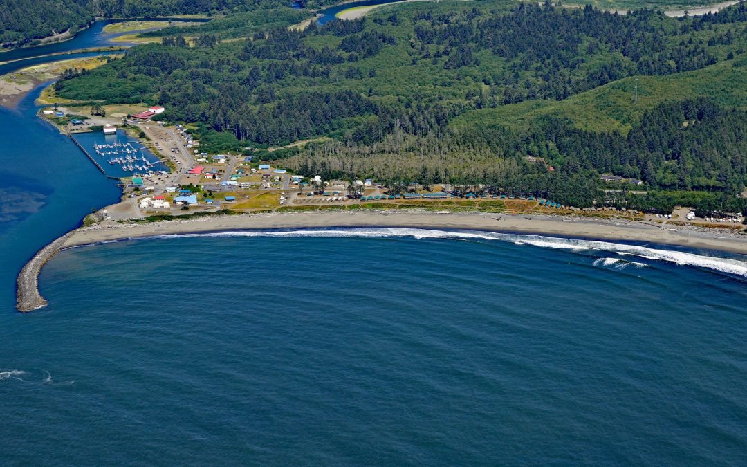
La Push is the traditional community of the Quileute people situated at the mouth of the Quillayute River within the Quileute Indian Reservation and surrounded by the coastal strip of Olympic National Park, about 32 miles (51 km) south of Neah Bay and 12 miles (19 km)...
by CoastView | Nov 11, 2024 | 2024, Alaska, Biodiversity, Canneries, Communities, Developments, Embayments, Historical, Islands, Land Use, Rivers
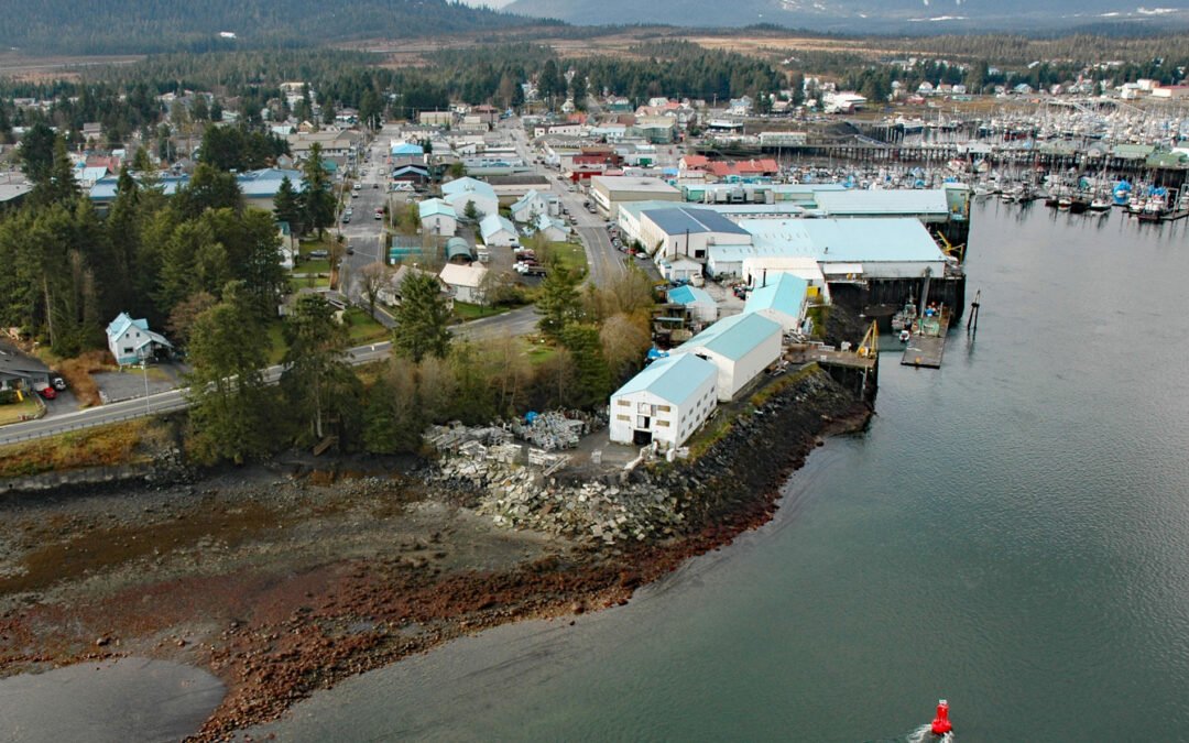
Petersburg is a community on the north end of Mitkof Island where the northern entrance to Wrangell Narrows meets Frederick Sound, about 116 miles (187 km) southeast of Juneau and 32 miles (52 km) northwest of Wrangell, Alaska. Mitkof Island is in the Alexander...
by CoastView | Nov 4, 2024 | 2024, Biodiversity, California, Chemical Pollution, Coastal Features, Communities, Developments, Embayments, Freshwater, Historical, Land Use, Nitrogen Cycle, Phosphorus, Rivers
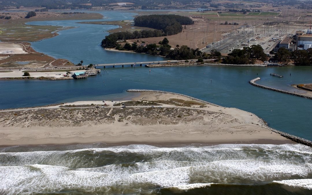
Elkhorn Slough is an estuary about 7 miles (11 km) long that connects with Monterey Bay at the community of Moss Landing, about 17 miles (27 km) southeast of Santa Cruz and 16 miles (26 km) north-northeast of Monterey, California. Elkhorn Slough is the third-largest...
by CoastView | Nov 3, 2024 | 2024, Alaska, Beaches, Biodiversity, Communities, Embayments, Historical, Islands, Land Use, Rivers
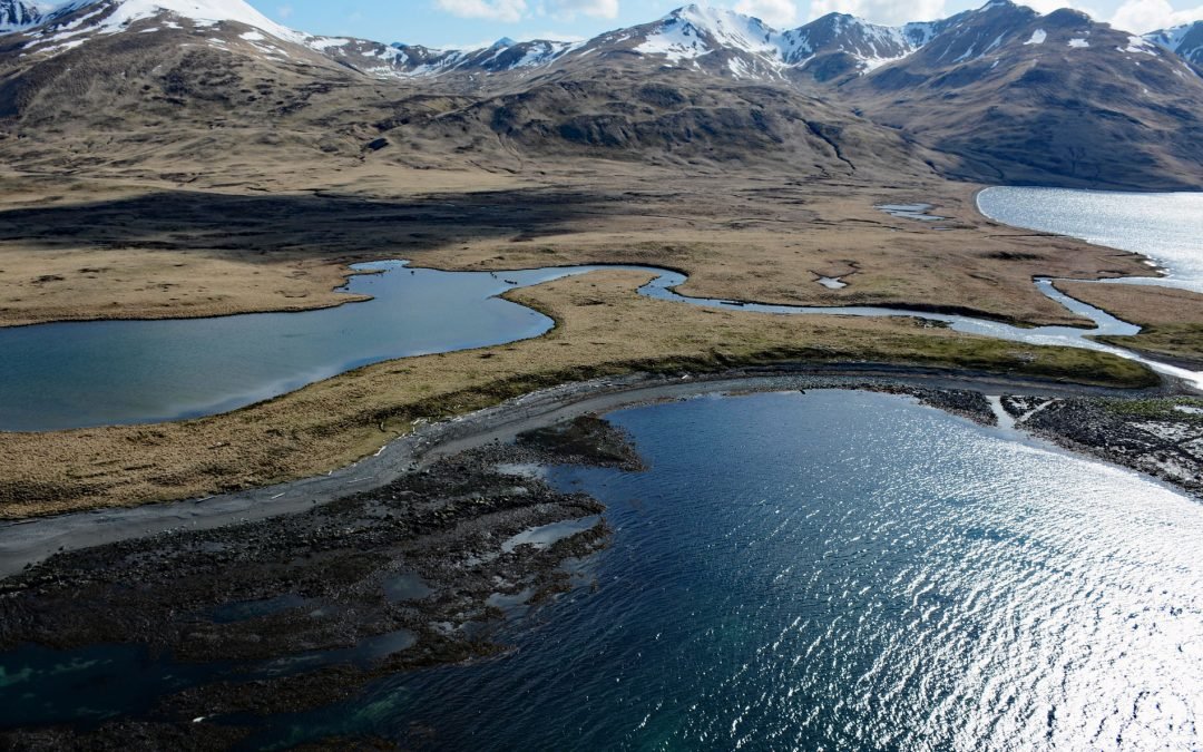
Kashega is an abandoned Unangan Aleut village on the Bering Sea coast of Unalaska Island, situated on a spit between Brennan Lake and Kashega Bay, about 79 miles (127 km) northeast of Nikolski and 39 miles (63 km) southwest of Dutch Harbor, Alaska. Kashega Bay was...
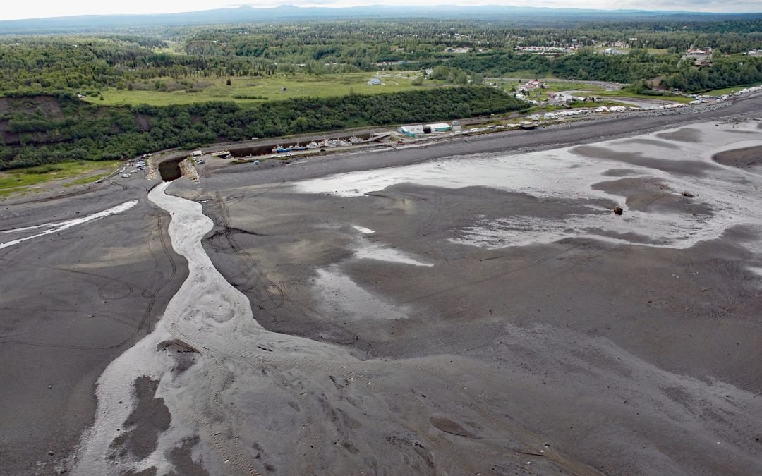
by CoastView | Nov 1, 2024 | 2024, Alaska, Beaches, Biodiversity, Climate Change, Communities, Freshwater, Historical, Rivers
Ninilchik is a community at Cape Ninilchik at the mouth of the Ninilchik River on the Kenai Peninsula and on the eastern shore of Cook Inlet, about 99 miles (160 km) southwest of Anchorage and 30 miles (48 km) north-northwest of Homer, Alaska. Road access to the...
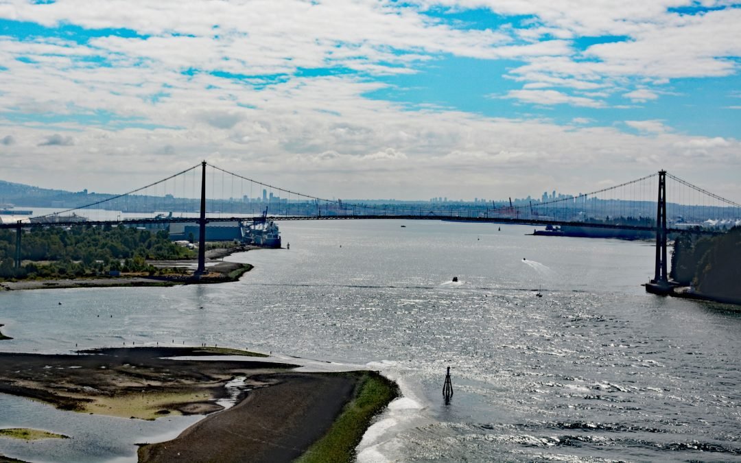
by CoastView | Sep 27, 2024 | 2024, British Columbia, Chemical Pollution, Coastal Features, Communities, Developments, Embayments, Historical, Land Use, Parks, Rivers
Lions Gate Bridge spans Burrard Inlet at the First Narrows, a strait about 1,312 feet (400 m) wide between Prospect Point in Stanley Park to the south and the sandy shoals of the Capilano River mouth to the north, about 2 miles (3.2 km) southeast of West Vancouver and...