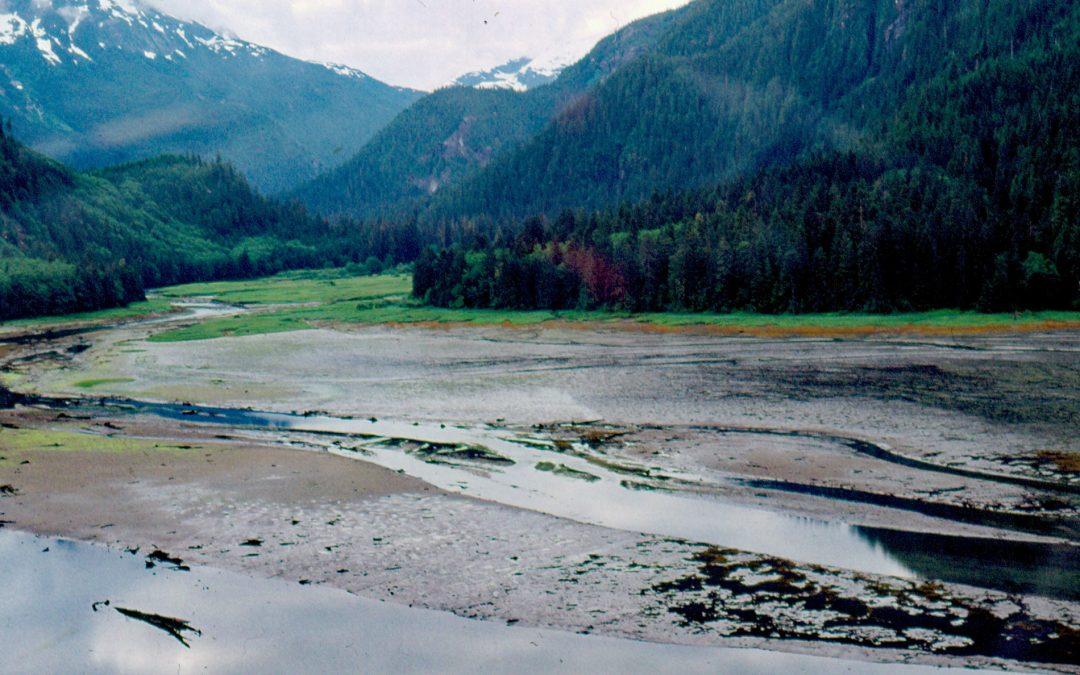
by CoastView | Jan 5, 2026 | 2026, British Columbia, Coastal Features, Embayments, January 2026, Natural History, Rivers
Listen to the article here https://coastview.org/wp-content/uploads/2025/12/KiltuishRiver.mp3 The Kiltuish River originates in the Kitimat Ranges and flows approximately 16 miles (25 km) north to Kiltuish Inlet, an arm of Gardner Canal, about 103 miles (166 km)...
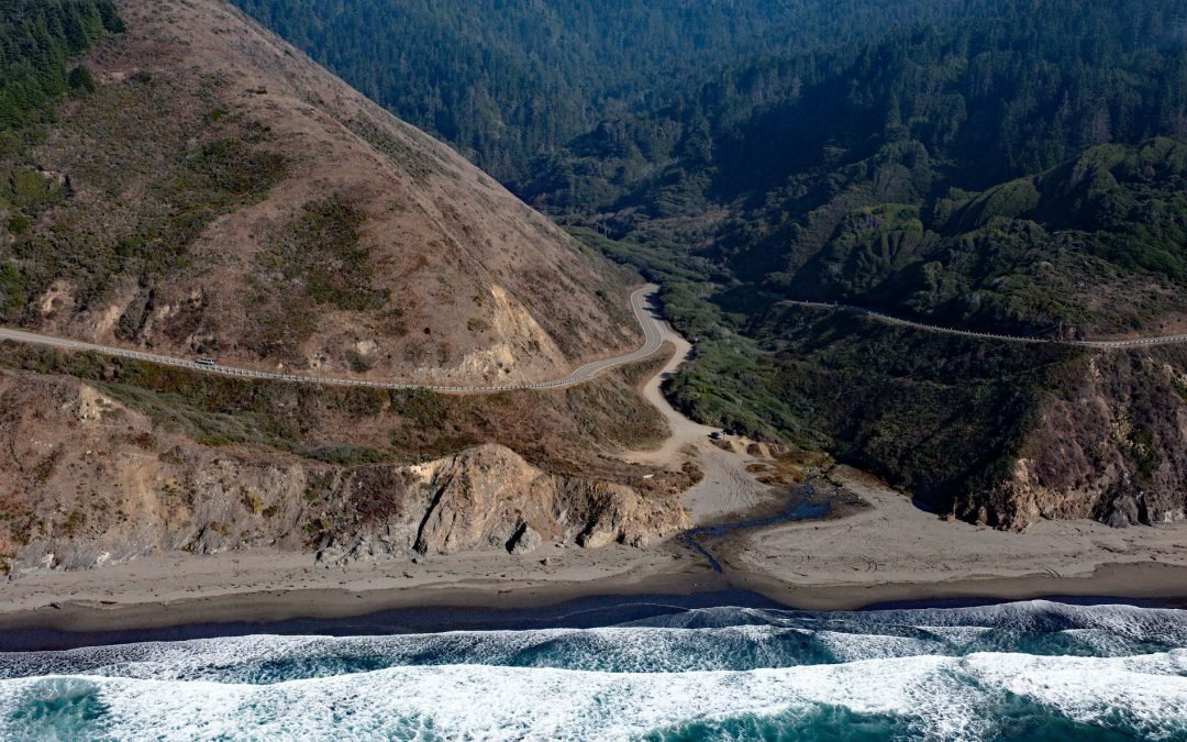
by CoastView | Jan 2, 2026 | 2026, Beaches, California, Coastal Features, January 2026, Land Use, Natural History, Rivers
Listen to the article here https://coastview.org/wp-content/uploads/2025/12/BlueBeach.mp3 Chadbourne Gulch is a small stream that flows into the Pacific Ocean at Blues Beach, located between Bell Point to the north and Bruhel Point to the south, approximately 12 miles...
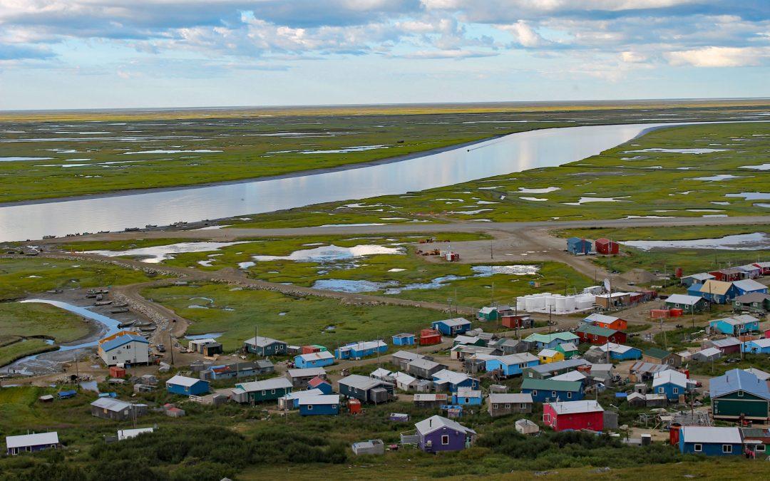
by CoastView | Jan 1, 2026 | 2026, Alaska, Coastal Features, Communities, January 2026, Land Use, Natural History, Rivers
Listen to the article here https://coastview.org/wp-content/uploads/2025/12/ScammonBay.mp3 Scammon Bay is a small community on the left bank of the Kun River about 1 mile (1.6 km) upstream from its mouth in the Yukon-Kuskokwim Delta, and lies approximately 147 miles...

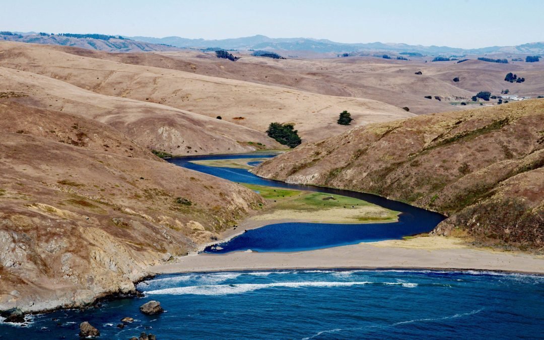
by CoastView | Dec 20, 2025 | 2025, California, Coastal Features, Communities, December 2025, Developments, Embayments, Historical, Land Use, Mines, Rivers
Listen to the article here https://coastview.org/wp-content/uploads/2025/12/OceanRoar.mp3 Ocean Roar is a small cluster of buildings located at the mouth of Walker Creek on Tomales Bay, about 2.3 miles (3.7 km) southwest of Tomales and 16 miles (26 km) west of...
by CoastView | Dec 14, 2025 | 2025, Beaches, California, Coastal Features, December 2025, Embayments, Historical, Land Use, Natural History, Rivers
Listen to the article here https://coastview.org/wp-content/uploads/2025/12/EsterodeSanAntonio.mp3 Estero de San Antonio is a small coastal lagoon formed by a sandbar damming Stemple Creek, located 5.75 miles (9 km) southeast of the community of Bodega Bay and 1.5...
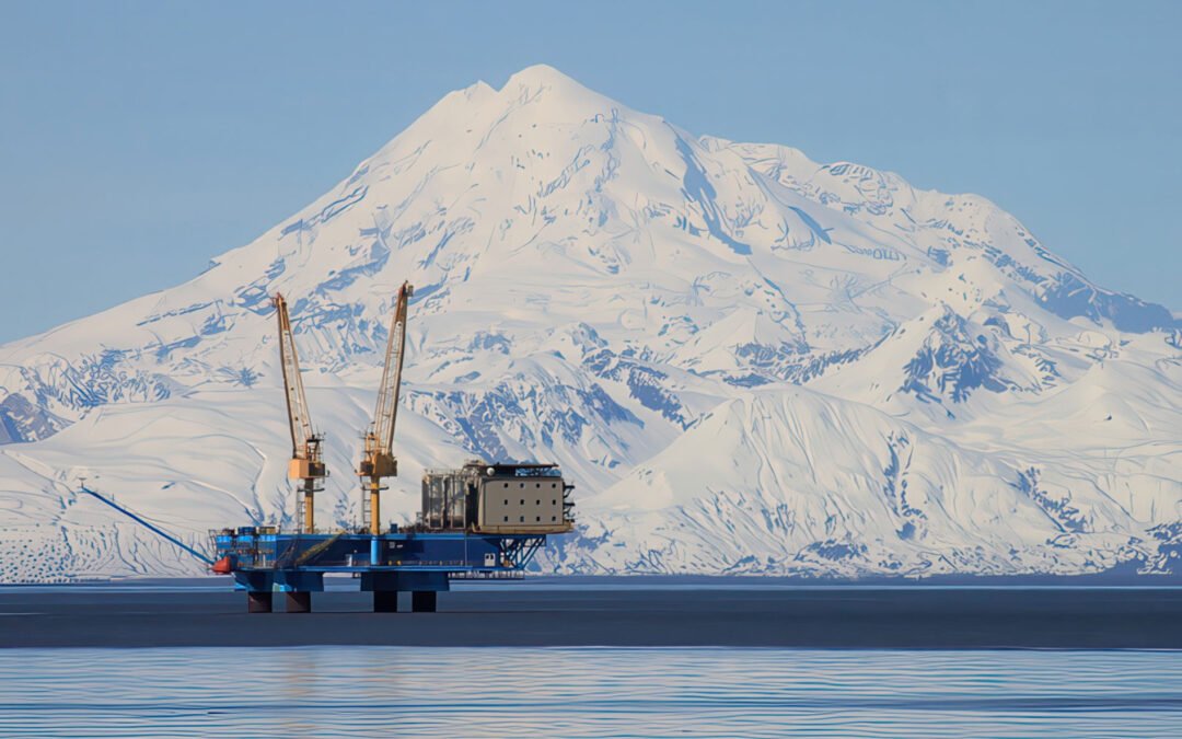
by CoastView | Dec 13, 2025 | 2025, Alaska, Coastal Features, December 2025, Developments, Land Use, Natural History, Rivers
Listen to the article here https://coastview.org/wp-content/uploads/2025/12/RedoubtVolcano.mp3 Redoubt Volcano, with a summit elevation of 10,197 feet (3,109 m), is in the Aleutian Range on the Alaska Peninsula, situated between the Drift River to the north and the...