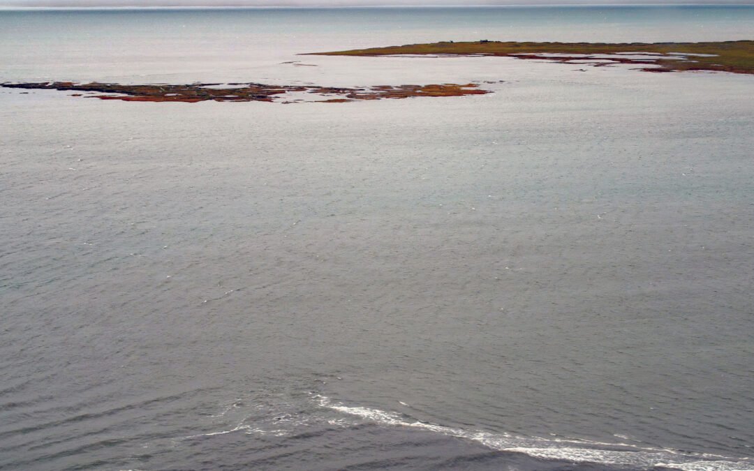
by CoastView | Mar 7, 2024 | 2024, Alaska, Beaches, Climate Change, Coastal Features, Embayments, Historical, Islands, Land Use, Natural History, Rivers
Leffingwell Camp is situated on Flaxman Island, a shape-shifting barrier island separating the Beaufort Sea to the north and Lion Bay to the south, about 58 miles (94 km) east of Deadhorse and 58 miles (94 km) west of Kaktovik, Alaska. Barrier islands stretch across...

by CoastView | Feb 29, 2024 | 2024, Beaches, Biodiversity, Coastal Features, Land Use, Natural History, Oregon, Rivers
Floras Creek starts from an elevation of roughly 2,786 feet (849 m) on the north flank of Edson Butte in the Oregon Coast Range and flows generally west for 13 miles (21 km), draining a watershed of 51,652 acres (20,903 ha) to the outlet of Floras Lake where the...
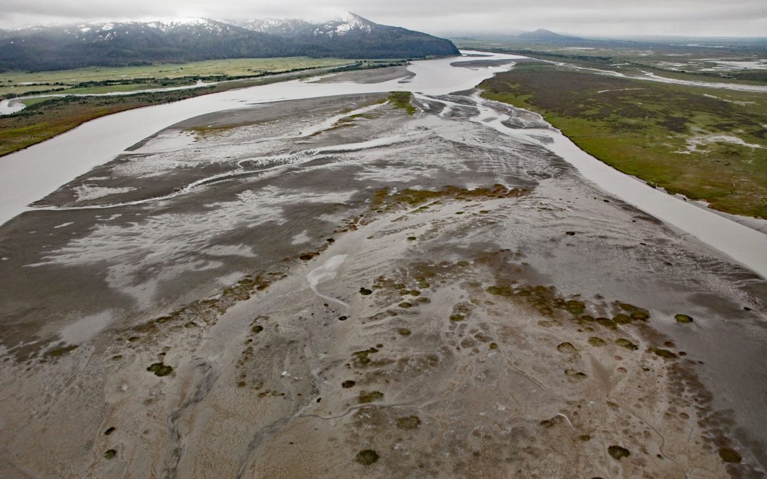
by CoastView | Feb 26, 2024 | 2024, Alaska, Biodiversity, Canneries, Coastal Features, Embayments, Glaciers, Land Use, Natural History, Rivers
Bering River starts from a series of ice-marginal lakes and streams draining from the Martin River, Steller, and Bering glaciers, and flows generally south-southwest for 18 miles ( km) to Controller Bay on the Gulf of Alaska, about 63 miles (102 km) west of Cape...

by CoastView | Feb 25, 2024 | 2024, Biodiversity, British Columbia, Coastal Features, Developments, Land Use, Natural History, Rivers
Scotia River starts at an elevation of 5,023 feet (1,531 m) in the Coast Range and flows generally north-northwest for 14 miles (22 km) through the Great Bear Rainforest, draining a watershed of 33,360 acres (13,500 ha) to the southern shore, or left bank, of the...

by CoastView | Feb 23, 2024 | 2024, Beaches, Biodiversity, California, Coastal Features, Communities, Land Use, Natural History, Rivers
Mad River starts in the Coast Range at an elevation of 4,845 ft (1,477 m) and flows generally northwest for 113 miles (182 km), draining a watershed of 318,080 acres (128,722 ha), and enters the Pacific Ocean about 12 miles (19 km) north of Eureka and 1.8 miles (3 km)...
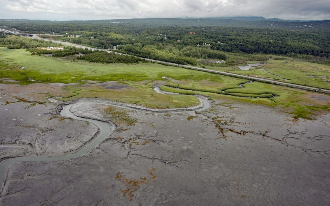
by CoastView | Feb 22, 2024 | 2024, Alaska, Biodiversity, Coastal Features, Embayments, Land Use, Natural History, Parks, Rivers
Rabbit Creek starts at the outlet of Rabbit Lake, at the base of the west flank of North Yuyanq’ Ch’ex in the Chugach Mountains at an elevation of 3,082 feet (940 m), and flows generally west-northwest for 26 miles (42 km) draining a watershed of 9,152 acres (3,704...