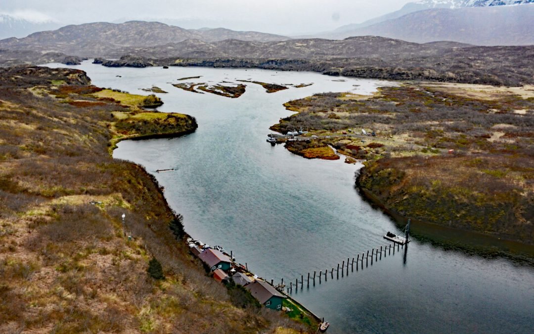
by CoastView | Jun 3, 2024 | 2024, Communities, Developments, Embayments, Natural History, Rivers
Chignik River starts at Black Lake and flows south for about 8 miles to Chignik Lake, which is about 7 miles (11 km) long, and then the river continues flowing east for another 2 miles (3.2 km) to Chignik Lagoon, past the fish weir located about 12 miles (19 km)...
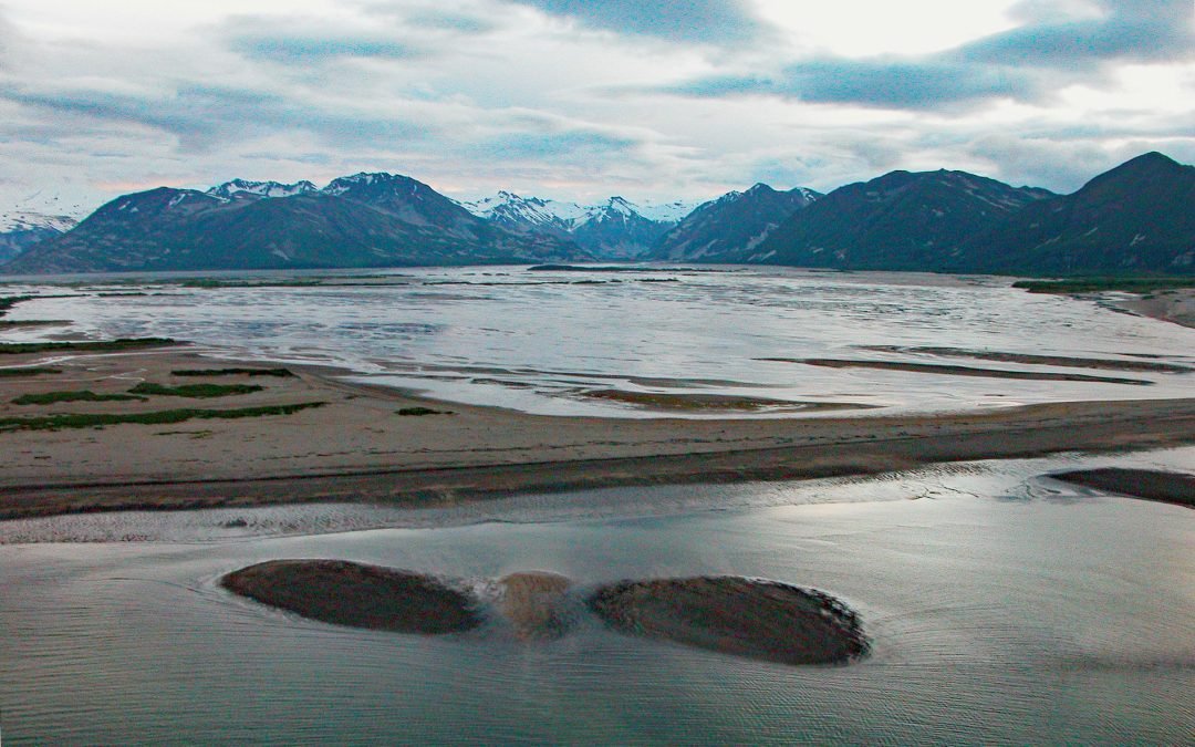
by CoastView | May 31, 2024 | 2024, Alaska, Communities, Embayments, Historical, Parks, Rivers
Katmai Bay is about 9 miles (14.5 km) across, located at the mouth of the Katmai River on the Shelikof Strait coast of the Alaska Peninsula in Katmai National Park and Preserve, about 93 miles (150 km) west-northwest of Kodiak and 77 miles (124 km) southeast of King...
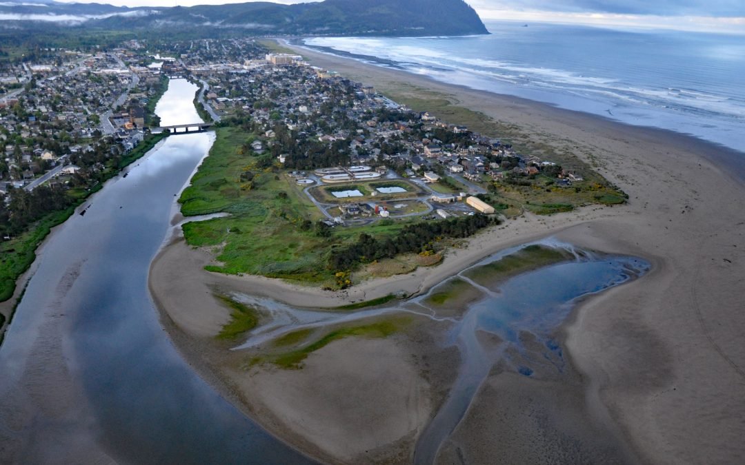
by CoastView | May 28, 2024 | 2024, Communities, Oregon, Rivers
Necanicum River is approximately 21 miles (34 km) long draining a watershed of 84 square miles (21,756 ha), and forms the first estuary south of the Columbia River about 70 miles (113 km) northwest of Portland and 13 miles (21 km) southwest of Astoria at the coastal...
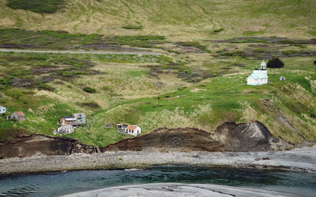
by CoastView | May 23, 2024 | 2024, Alaska, Embayments, Historical, Islands, Rivers
Karluk is a historical fishing community situated on a barrier spit at the mouth of Karluk Lagoon on the west coast of Kodiak Island, about 301 miles (485 km) southwest of Anchorage and 88 miles (142 km) southwest of Kodiak, Alaska. The Karluk River flows north and...

by CoastView | May 13, 2024 | 2024, Alaska, Glaciers, Parks, Rivers
Dangerous River starts at Harlequin Lake in the Brabazon Mountains of the Fairweather Range and flows southwest for 16 miles (26 km) to the Gulf of Alaska, about 102 miles (165 km) northwest of Gustavus and 50 miles (81 km) southeast of Yakutat, Alaska. The name was...

by CoastView | May 4, 2024 | 2024, Alaska, Coastal Features, Rivers
The Red River is a stream on Kodiak Island that flows south for about 4.5 miles (7 km) to Shelikof Strait, 2 miles (3.2 km) east of Bumble Bay, and about 80 miles (129 km) southwest of Kodiak and 6 miles (10 km) northwest of Ayakulik, Alaska. The name is a translation...