
by CoastView | Nov 3, 2023 | 2023, Alaska, Climate Change, Coastal Features, Communities, Land Use, Natural History, Rivers
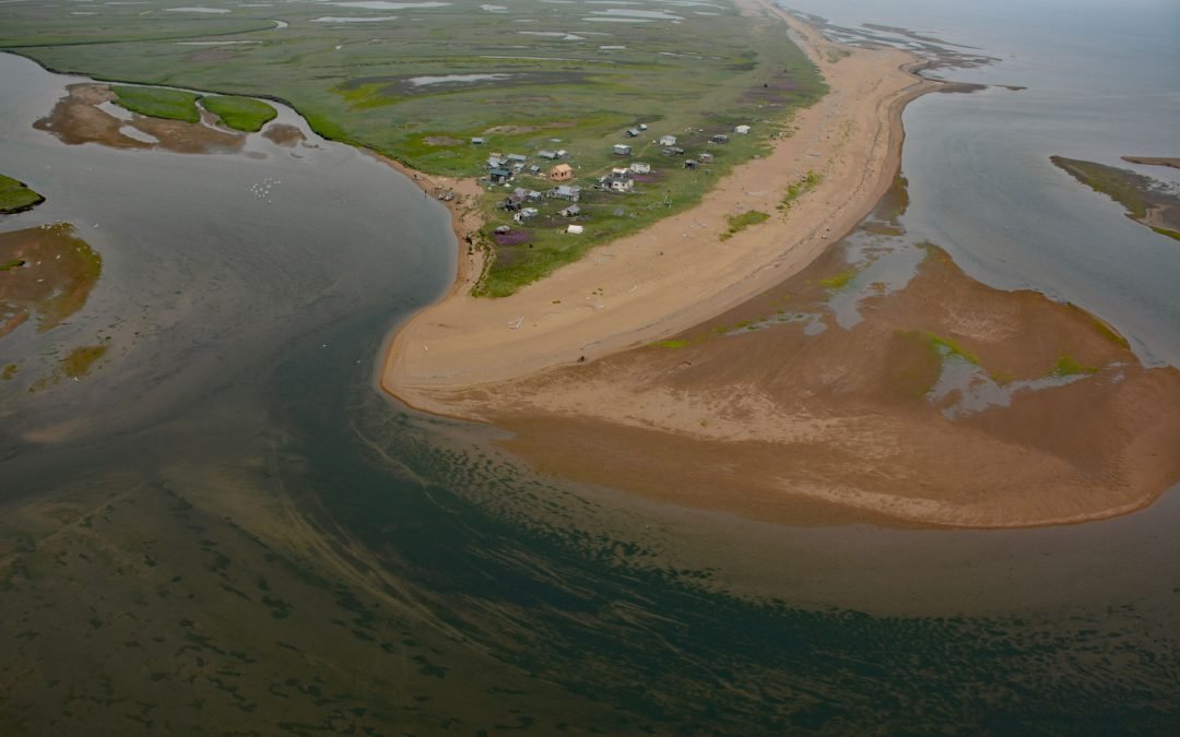
Quinhagak, or Kwinhagak, is a Central Yup’ik community situated on the Yukon-Kuskokwim Delta near the mouth of the Kanektok River, about 73 miles (118 km) south of Bethel and 45 miles (72 km) north of Goodnews Bay, Alaska. The name is anglicized from the...
by CoastView | Nov 1, 2023 | 2023, Alaska, Beaches, Biodiversity, Coastal Features, Communities, Embayments, Land Use, Natural History, Rivers
Moses Point is a fish camp, used mostly by residents of Elim, situated at the mouth of the Kwiniuk River on the northern shore of Norton Bay, about 100 miles (160 km) east of Nome and 31 miles (50 km) southwest of Koyuk, Alaska. The name Moses Point also refers to a...
by CoastView | Oct 27, 2023 | 2023, Alaska, Beaches, Biodiversity, Climate Change, Communities, Developments, Embayments, Land Use, Natural History, Rivers
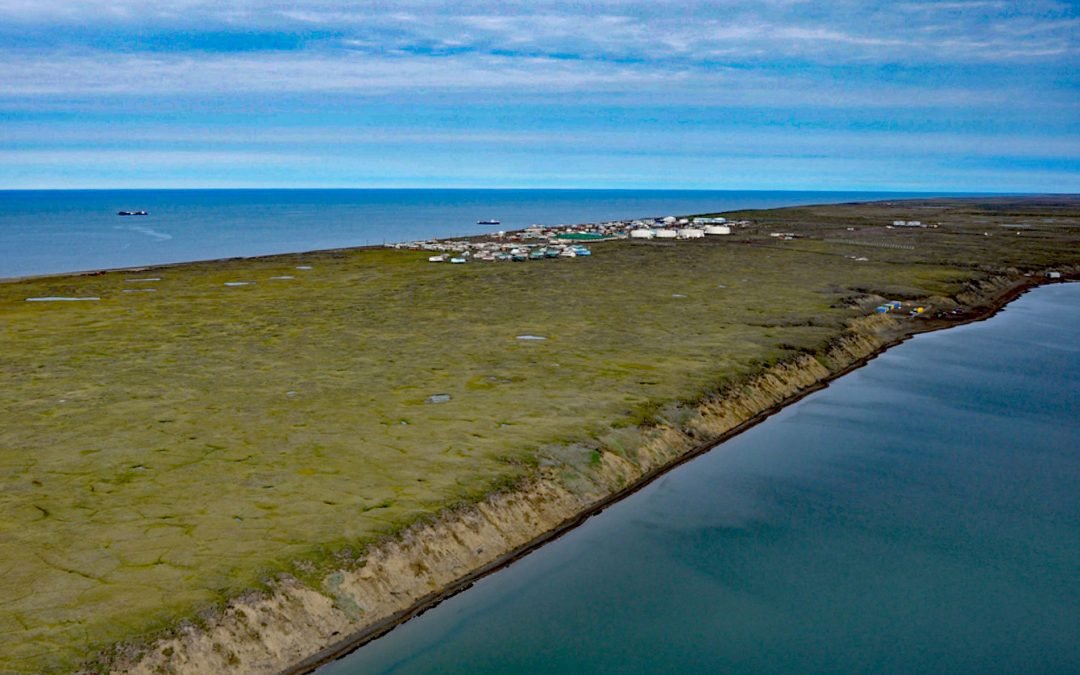
Wainwright is an Iñupiat community on the Chukchi Sea coastline situated on a barrier beach adjacent to Wainwright Inlet and the Kuk River, about 94 miles (151 km) northeast of Point Lay and 86 miles (138 km) southwest of Utqiaġvik, Alaska. The inlet is also known as...
by CoastView | Oct 26, 2023 | 2023, Alaska, Biodiversity, Coastal Features, Embayments, Islands, Land Use, Natural History, Parks, Rivers
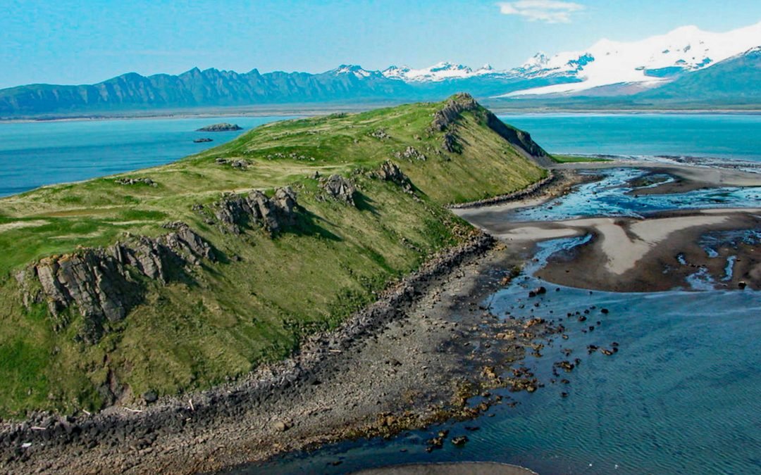
Ninagiak Island is about 1.2 miles (2 km) long and 0.2 miles wide, located in Hallo Bay near the mouth of the Ninagiak River on the south coast of the Alaska Peninsula in Shelikof Strait, about 122 miles (197 km) southwest of Homer and 75 miles (121 km) northwest of...

by CoastView | Oct 25, 2023 | 2023, Beaches, Biodiversity, Coastal Features, Historical, Land Use, Natural History, Parks, Rivers, Washington
Lyre River starts at the outlet of Lake Crescent in Olympic National Park and flows generally northwest for 5 miles (8 km) to Low Point on the Strait of Juan de Fuca draining a watershed of 43,200 acres (17,482 ha), about 21 miles (34 km) southeast of Clallam Bay and...
by CoastView | Oct 24, 2023 | 2023, Alaska, Coastal Features, Embayments, Land Use, Parks, Rivers
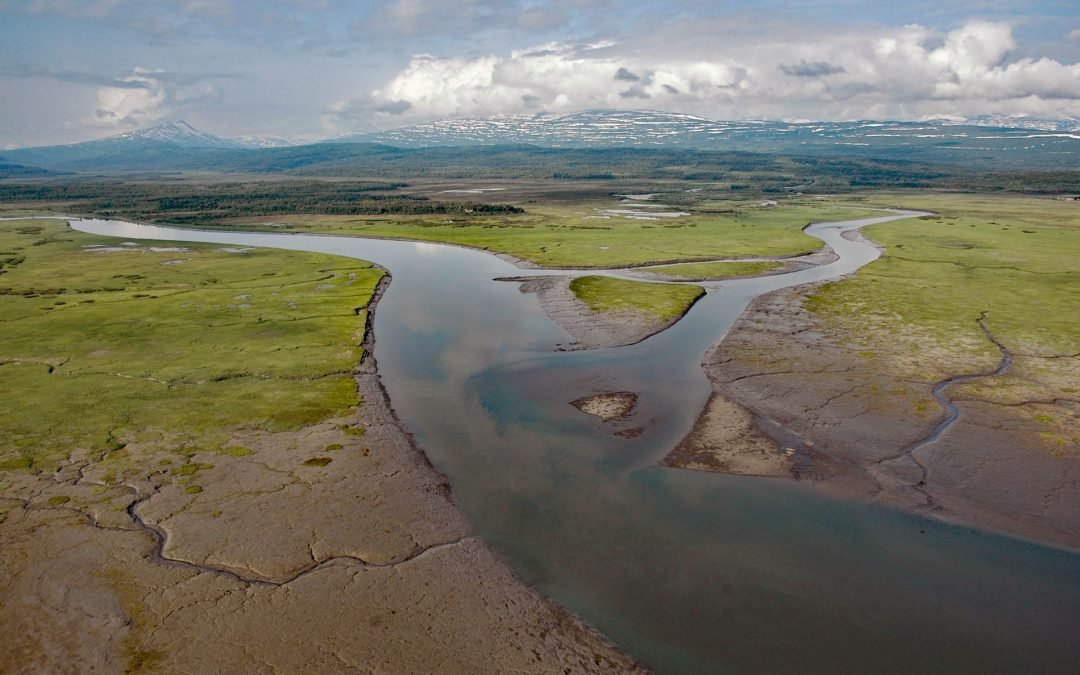
Kamishak River starts from an unnamed lake at an elevation of 2,700 feet (823 m) in a saddle between two peaks in the Aleutian Range and first flows southeast for 10 miles (16 km) and then north-northeast for 28 miles (45 km) through Katmai National Park and Preserve...