
by CoastView | Oct 23, 2025 | 2025, Alaska, Biodiversity, Coastal Features, Developments, Embayments, Hatcheries, Historical, Islands, Land Use, Natural History, October 2025, Rivers
Listen to the article here https://coastview.org/wp-content/uploads/2025/07/Whitman-Creek.mp3 Whitman Creek is on the southeast coast of Revillagigedo Island, about 14 miles (23 km) north of Metlakatla and 7 miles (11 km) east-southeast of Ketchikan, Alaska. The...

by CoastView | Oct 21, 2025 | 2025, Beaches, Best of 2024, Biodiversity, California, Coastal Features, Communities, Developments, Historical, Land Use, Lighthouses, Natural History, October 2025, Parks, Rivers
Listen to the article here https://coastview.org/wp-content/uploads/2025/07/Border-Field.mp3 Border Field State Park is part of the Tijuana River National Estuarine Research Reserve, adjacent to the urban neighborhood of Playas de Tijuana, Mexico, located about 12...
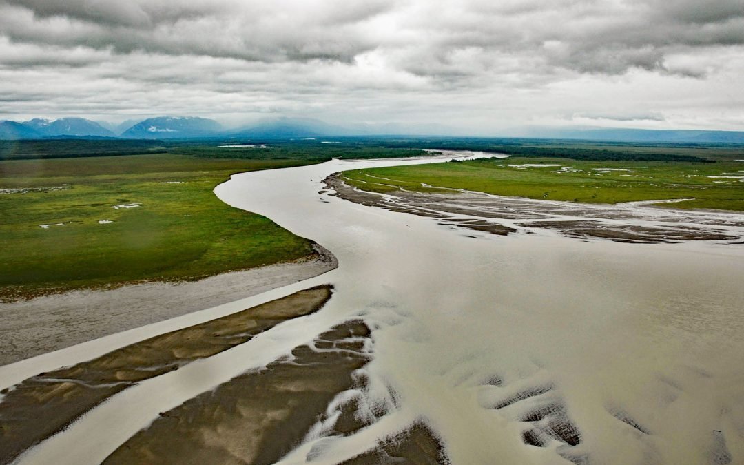
by CoastView | Oct 16, 2025 | 2025, Alaska, Coastal Features, Developments, Embayments, Glaciers, Historical, Land Use, October 2025, Parks, Rivers
Listen to the article here https://coastview.org/wp-content/uploads/2025/07/McArthur-River.mp3 McArthur River flows southeast to Trading Bay on the west coast of Cook Inlet, approximately 65 miles (105 km) southwest of Anchorage and 29 miles (46 km) northwest of...
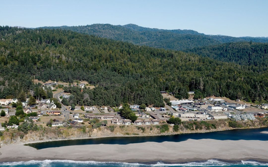
by CoastView | Oct 14, 2025 | 2025, Biodiversity, California, Coastal Features, Communities, Developments, Freshwater, Historical, Land Use, Natural History, October 2025, Rivers
Listen to the article here https://coastview.org/wp-content/uploads/2025/06/Gualala-River.mp3 The Gualala River flows into the Pacific Ocean at the community of Gualala, approximately 92 miles (148 km) northwest of San Francisco and 40 miles (64 km) south-southeast of...
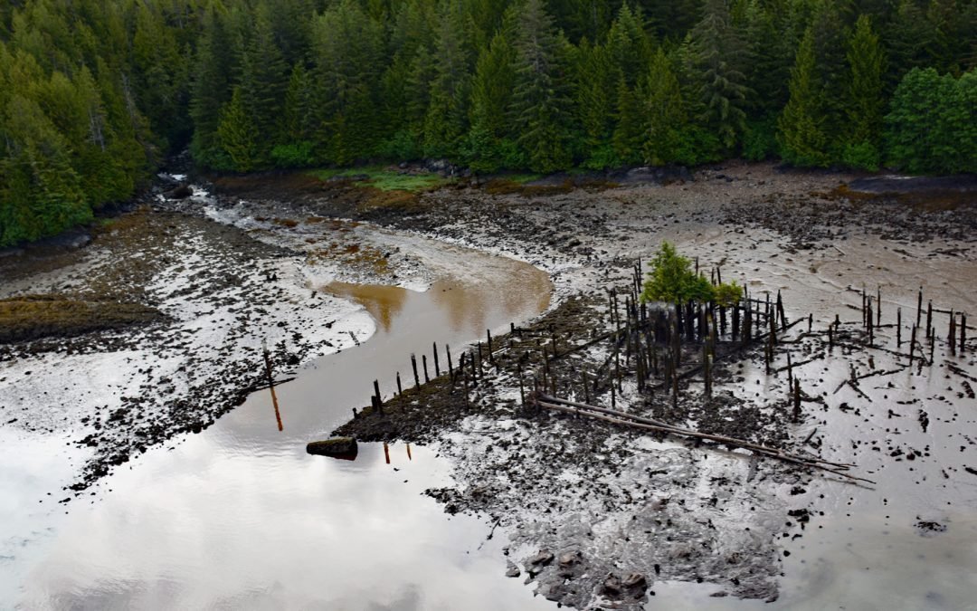
by CoastView | Oct 10, 2025 | 2025, British Columbia, Canneries, Coastal Features, Communities, Embayments, Historical, Land Use, Natural History, October 2025, Rivers
Listen to the article here https://coastview.org/wp-content/uploads/2025/06/Claxton.mp3 Claxton is a historical salmon cannery and community located at the mouth of Claxton Creek on the eastern shore of Telegraph Passage in the Skeena River estuary, about 66 miles...
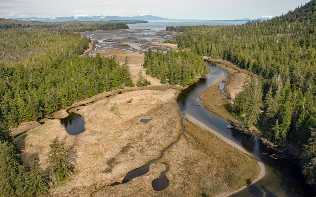
by CoastView | Oct 8, 2025 | 2025, Alaska, Biodiversity, Coastal Features, Embayments, Land Use, Natural History, October 2025, Rivers
Listen to the article here https://coastview.org/wp-content/uploads/2025/06/Black-Bear-Creek.mp3 Black Bear Creek is located on the southwest coast of the Cleveland Peninsula, approximately 52 miles (84 km) south of Wrangell and 35 miles (56 km) northwest of...