by CoastView | Aug 3, 2024 | 2024, Coastal Features, Headlands, Historical, Land Use, Oregon, Parks
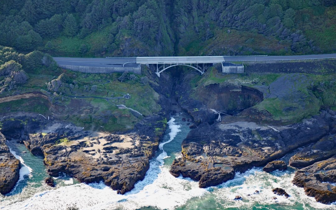
Thor’s Well is at Cook’s Chasm, a fissure in the rock approximately 400 feet (122 m) long and 60 feet (18 m) wide between Captain Cook Point and Cape Perpetua, about 20 miles (32 km) north of Florence and 2 miles (3.2 km) south of Yachats, Oregon. The...
by CoastView | Aug 2, 2024 | 2024, Alaska, Beaches, Chemical Pollution, Embayments, Historical, Islands, Shipwrecks
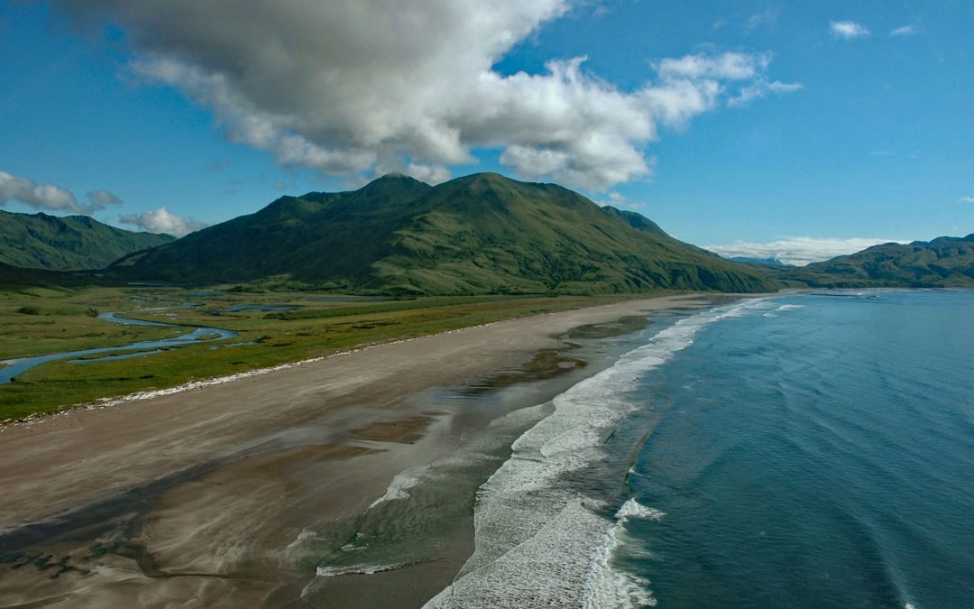
Ocean Bay is on the southeast shore of Sitkalidak Island in the Kodiak Archipelago, about 56 miles (90 km) southwest of Kodiak and 9 miles (15 km) southeast of the village of Old Harbor, Alaska. The Kodiak Archipelago is in the western Gulf of Alaska and has about 32...
by CoastView | Aug 1, 2024 | 2024, British Columbia, Canneries, Communities, Historical, Rivers
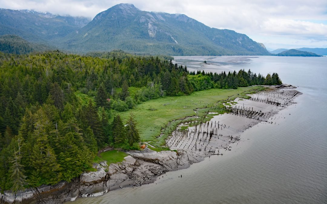
Port Essington is an abandoned cannery town on the south bank of the Skeena River estuary at the confluence of the Ecstall River, about 61 miles (98 km) southwest of Terrace and 18 miles (29 km) southeast of Prince Rupert, British Columbia. It is located on the...
by CoastView | Jul 31, 2024 | 2024, Alaska, Coastal Features, Glaciers, Islands, Land Use, Mines, Natural History, Rivers
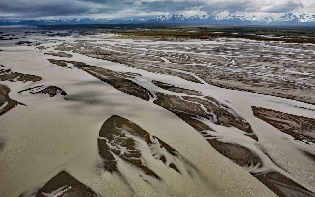
The Copper River watershed drains about 24,000 square miles (62,000 sq km) in the Wrangell, Chugach, and Saint Elias mountains and the mainstem flows for about 290 miles (470 km) to the Gulf of Alaska where it creates a wide delta, about 195 miles west-northwest of...
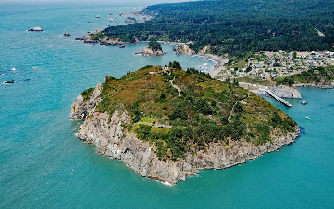
by CoastView | Jul 30, 2024 | 2024, California, Communities, Embayments, Headlands, Historical, Lighthouses
Trinidad Head is a prominent headland joined to the mainland by a narrow isthmus adjacent to the town of Trinidad and protecting Trinidad Bay, about 48 miles (77 km) south of Crescent City and 18 miles (29 km) north of Eureka, California. The bay is one of the few...
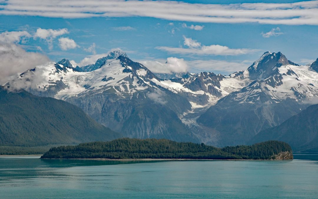
by CoastView | Jul 29, 2024 | 2024, Alaska, Climate Change, Embayments, Glaciers, Historical, Islands, Parks, Shipwrecks
Cenotaph Island is approximately in the middle of Lituya Bay, a fjord formed primarily by the Crillon and Lituya glaciers in Glacier Bay National Park and Preserve, about 117 miles (189 km) west-northwest of Juneau and 97 miles (156 km) southeast of Yakutat, Alaska....

by CoastView | Jul 28, 2024 | 2024, Beaches, Biodiversity, Coastal Features, Historical, Land Use, Oregon, Rivers, Shipwrecks
Camp Castaway is a historical site on North Spit of Coos Bay, a sandy, vegetated peninsula separating the estuary of the Coos River from the Pacific Ocean, about 3.8 miles (6 km) west of North Bend and 1 mile (1.6 km) north of Charleston, Oregon. The spit was the site...

by CoastView | Jul 27, 2024 | 2024, Alaska, Canneries, Communities, Developments, Embayments, Historical, Islands
Larsen Bay is a small village and historical salmon cannery on Larsen Bay, an embayment that extends 6 miles (9.6 km) off of Uyak Bay on the west coast of Kodiak Island, about 125 miles (202 km) southeast of King Salmon and 58 miles (94 km) west-southwest of Kodiak,...
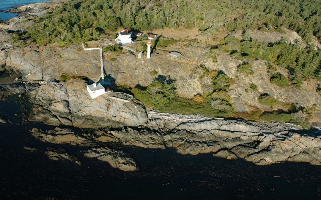
by CoastView | Jul 26, 2024 | 2024, British Columbia, Coastal Features, Developments, Historical, Islands, Lighthouses, Parks, Shipwrecks
Discovery Island is part of a group of islands in Oak Bay off the southeastern tip of Vancouver Island at Sea Bird Point, about 17 miles (27 km) southeast of Sidney and 6.5 miles (10.5 km) east of downtown Victoria, British Columbia. Discovery Island is about 2.5...
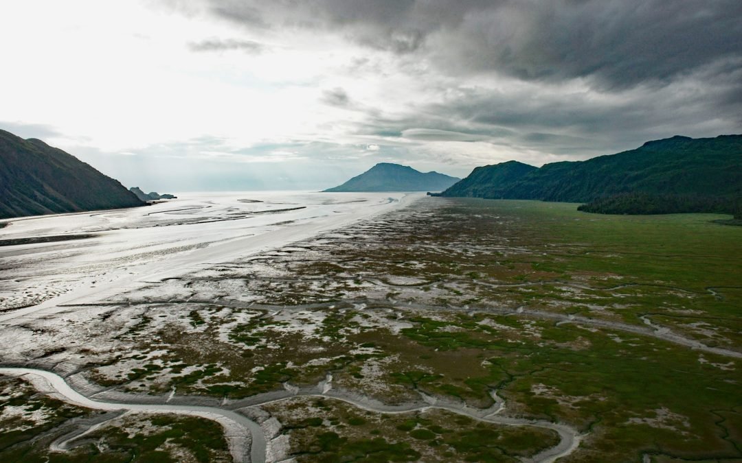
by CoastView | Jul 25, 2024 | 2024, Alaska, Canneries, Coastal Features, Embayments, Glaciers, Historical, Islands, Parks, Rivers
Tuxedni Bay is an estuary that extends southeast for 14 miles (23 km) from the mouth of Tuxedni River to Cook Inlet at Chisik Island, about 59 miles (95 km) northwest of Homer and 57 miles (92 km) southwest of Kenai, Alaska. The Dena’ina name for the bay was...