by CoastView | Jul 14, 2024 | 2024, Alaska, Chemical Pollution, Developments, Embayments, Historical, Islands, Mines, Shipwrecks
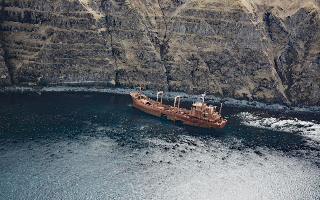
Aoyagi Maru is a Japanese flagged refrigerant ship that grounded on the south shore of Lost Harbor on Akun Island, about 135 miles (218 km) southwest of Cold Bay and 9 miles (14.5 km) northeast of Akutan, Alaska. Lost Harbor is a protected embayment about 1.5 miles...
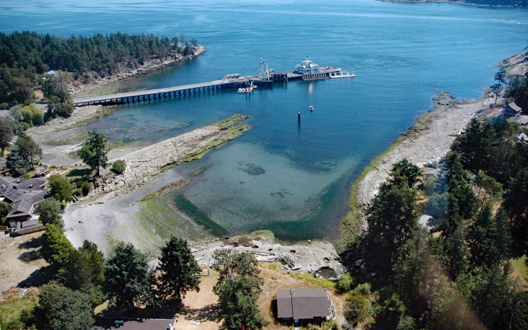
by CoastView | Jul 13, 2024 | 2024, British Columbia, Communities, Developments, Embayments, Historical, Islands, Land Use
Sturdies Bay is an embayment near the northern entrance to Active Pass between Rip Point and Burrill Point on the southeast shore of Galiano Island, one of the southern Gulf Islands, about 19 miles (31 km) southwest of Delta and 16 miles (26 km) north-northwest of...
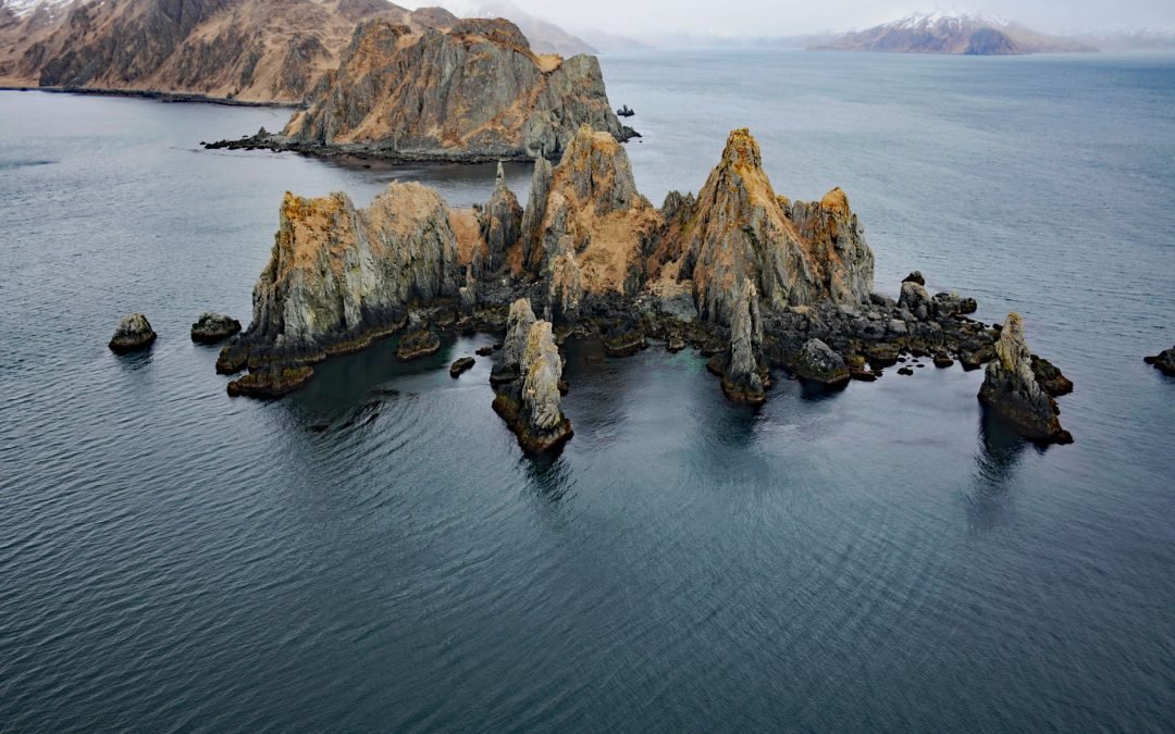
by CoastView | Jul 12, 2024 | 2024, Alaska, Chemical Pollution, Communities, Embayments, Headlands, Historical, Islands, Shipwrecks
Cathedral Rocks is an island 0.3 miles (0.5 km) west of Cathedral Point on the northern shore of Makushin Bay, on the west coast of Unalaska Island in the Eastern Aleutians, about 98 miles (158 km) northwest of Nikolski and 18 miles (29 km) southwest of Dutch Harbor,...
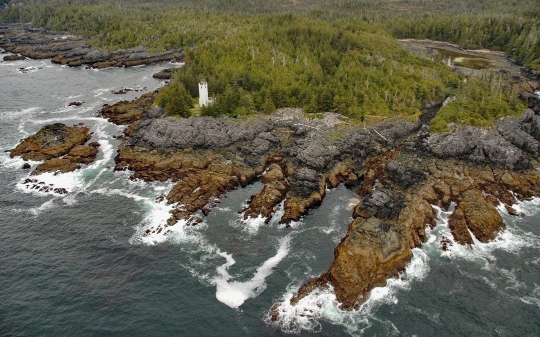
by CoastView | Jul 11, 2024 | 2024, Alaska, Developments, Headlands, Historical, Lighthouses
Tree Point is a historic lighthouse on the east shore of Revillagigedo Channel on the Southeast Alaska mainland, about 42 miles (68 km) northwest of Prince Rupert, and 48 miles (77 km) southeast of Ketchikan, Alaska. The light is currently an active and important aid...
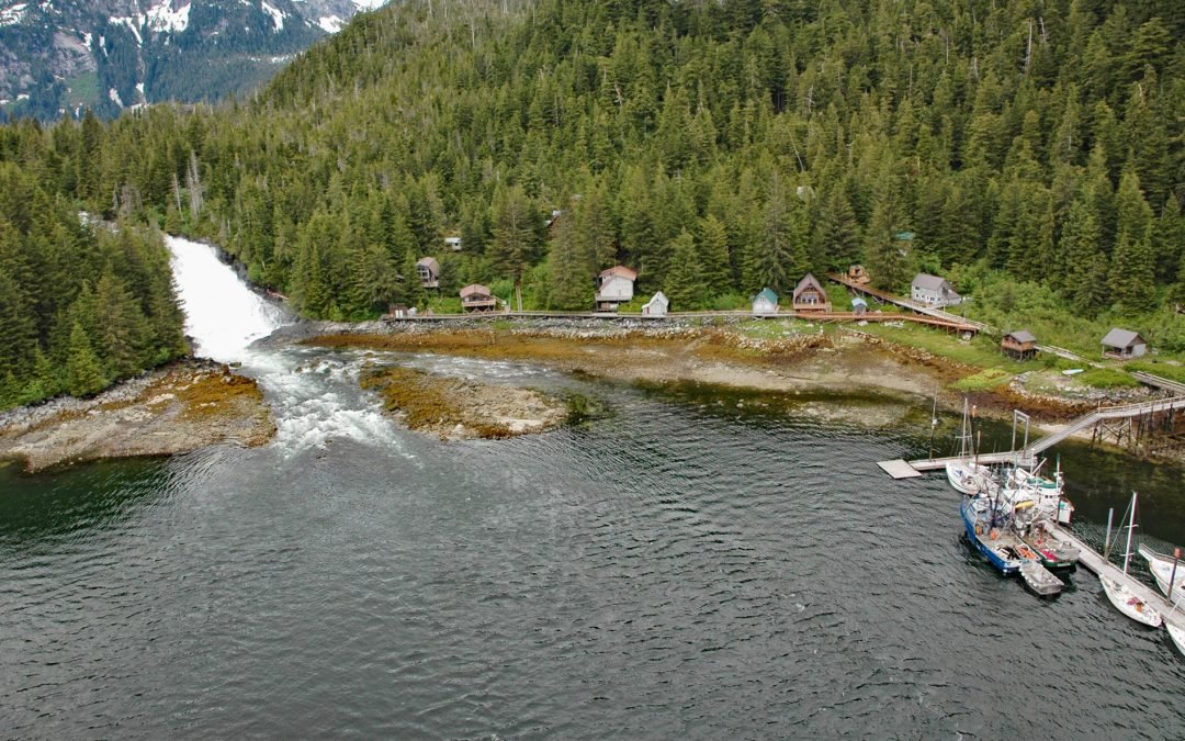
by CoastView | Jul 10, 2024 | 2024, Alaska, Coastal Features, Communities, Embayments, Historical, Islands, Rivers, Waterfalls
Baranof is a community located at the head of Warm Springs Bay, at the outlet of Baranof Lake, on the Chatham Strait coast of Baranof Island, about 86 miles (139 km) south-southwest of Juneau and 20 miles (32 km) east of Sitka, Alaska. The Tlingit name for the island...
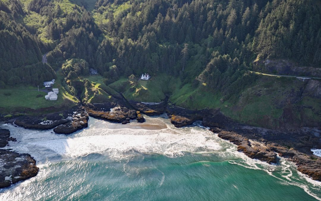
by CoastView | Jul 9, 2024 | 2024, Coastal Features, Headlands, Lighthouses, Oregon
Cleft of the Rock Light is a privately owned lighthouse located on Cape Perpetua, at the mouth of North Cape Creek, about 21 miles (34 km) north of Florence and 2 miles (3.2 km) south of Yachats, Oregon. The lighthouse is named after the Fanny Crosby hymn He Hideth My...
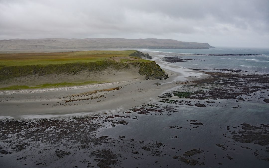
by CoastView | Jul 8, 2024 | 2024, Alaska, Developments, Historical, Islands, Land Use, Natural History, Parks
Chirikof Island is about 33,000 acres (13,000 ha) and part of the Kodiak Island Archipelago located in the western Gulf of Alaska, about 180 miles (290 km) southwest of Kodiak and 137 miles (221 km) east of Perryville, Alaska. Despite the extreme remoteness, the...
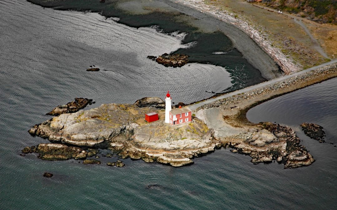
by CoastView | Jul 7, 2024 | 2024, Beaches, British Columbia, Coastal Features, Embayments, Historical, Islands, Lighthouses, Parks
Fisgard Island Light Station is located in Royal Roads off the southern shore of Vancouver Island at the entrance to Esquimalt Harbour, about 3.6 miles (5.8 km) west of Victoria and in the community of Colwood, British Columbia. In 1846, Commander James Woods surveyed...
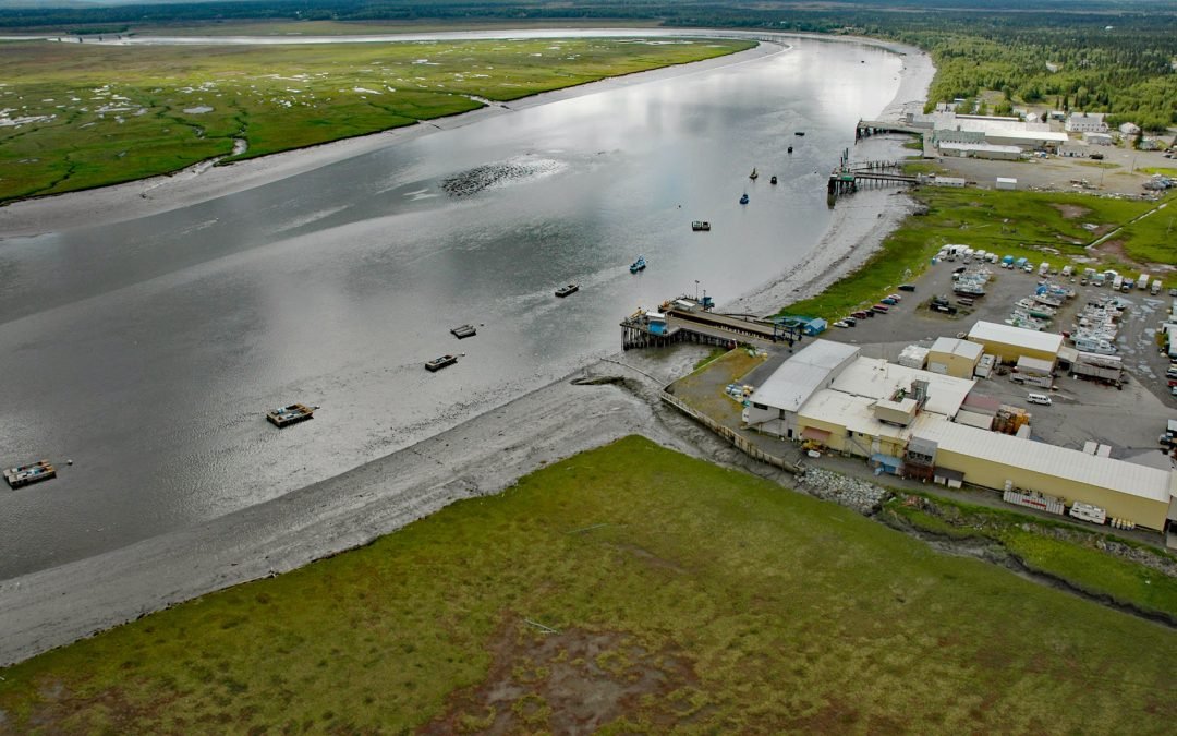
by CoastView | Jul 6, 2024 | 2024, Alaska, Biodiversity, Canneries, Communities, Freshwater, Historical, Rivers
Kenai River flows into Cook Inlet on the western shore of the Kenai Peninsula, about 65 miles (105 km) southwest of Anchorage and at the community of Kenai, Alaska. In June 1787, Stepan Zaikov on Saint Pavel of the Lebedev-Lastochkin Company established a post at the...
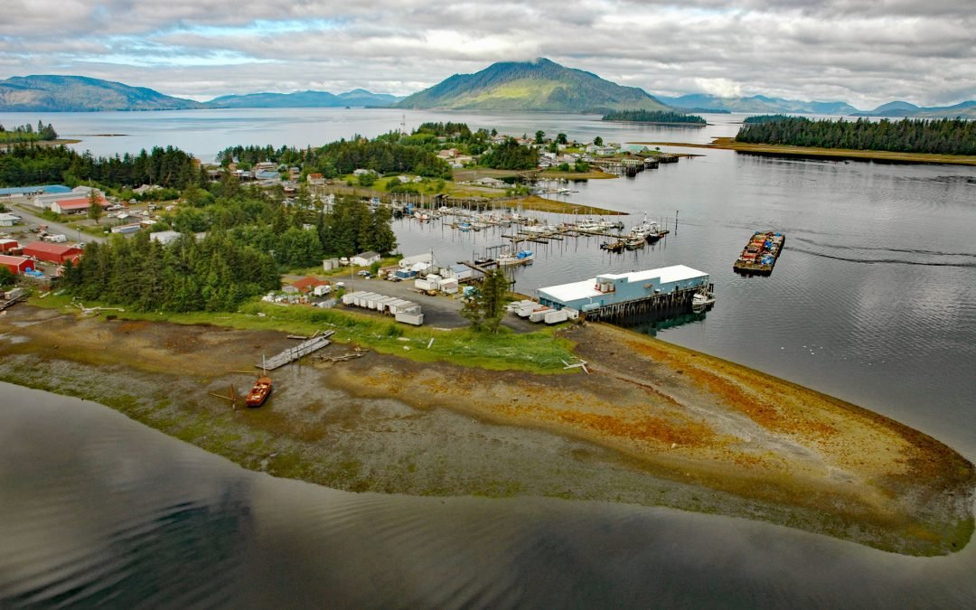
by CoastView | Jul 5, 2024 | 2024, Alaska, Canneries, Communities, Developments, Historical, Islands
Craig is a community situated on Craig Island connected by a causeway to the western coast of Prince of Wales Island approximately 56 miles (90 km) northwest of Ketchikan and 220 miles (350 km) south of Juneau, Alaska. This is the largest town on Prince of Wales...