LAST MONTH
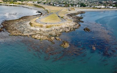
Clover Point, Ross Bay
Clover Point is a park of about 10 acres (4 ha) owned by the City of Victoria located between Ross Bay to the east and Finlayson Bay to the west at the southern tip of Vancouver Island, about 2.5 miles (4 km) southwest of Oak Bay and 1.6 miles (2.6 km) southeast of downtown Victoria, British Columbia.
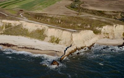
Cowell Ranch Beach, Half Moon Bay
Cowell Ranch Beach is at the southern end of Half Moon Bay near the ghost town of Purissima, and the northern boundary of the historical Cowell Ranch, about 38 miles (61 km) northwest of Santa Cruz and 2.8 miles (4.5 km) south of the community of Half Moon Bay, California.
Tahsis, Tahsis Inlet
Tahsis is a community on the west coast of Vancouver Island at the head of Tahsis Inlet which is the northern arm of Nootka Sound, about 50 miles (80 km) south-southeast of Port McNeill and 30 miles (48 km) west-northwest of Gold River, British Columbia.
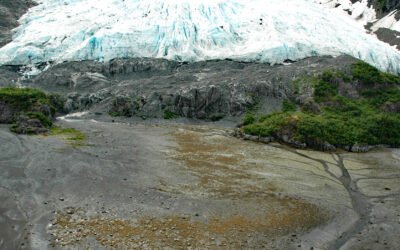
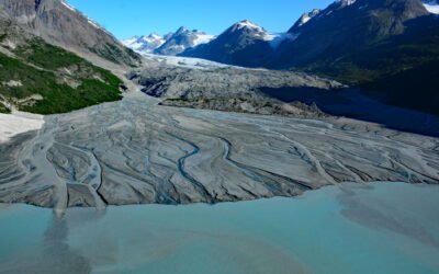
Lawrence Glacier, Blackstone Bay
Lawrence Glacier starts from several cirques situated at the northern extent of the Kenai Mountains at an elevation of roughly 3,000 feet (915 m) and flows generally northwest for 2.4 miles (4 km) to within a few hundred feet of tidewater at the south end of Willard Island in Blackstone Bay, about 84 miles (135 km) west-southwest of Valdez and 7 miles (11 km) south-southeast of Whittier, Alaska.
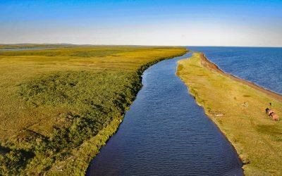
Tukrok River, Cape Krusenstern
Tukrok River flows generally east-southeast for 7 miles (11 km) from Krusenstern Lagoon to Kotzebue Sound in Cape Krusenstern National Monument, about 166 miles (268 km) northeast of Wales and 23 miles (37 km) northwest of Kotzebue, Alaska.
Tonsina Bay, Nuka Passage
Tonsina Bay is on the western shore of Nuka Passage at the base of Gore Point on the Kenai Peninsula, across from the southern end of Nuka Island, about 76 miles (122 km) south-southwest of Seward and 31 miles (50 km) south-southeast of Homer, Alaska.
Rendu Glacier, Glacier Bay National Park and Preserve
Rendu Glacier starts in the Fairweather Range at an elevation of roughly 4600 feet (1400 m) in British Columbia and flows generally southeast for about 1 mile (1.6 km) to the United States border between Mount Barnard to the southwest and Boundary Peak 159 to the northeast, and then continues for another 12 miles through Glacier Bay National Park and Preserve to Rendu Inlet, about 113 miles (182 km) southeast of Yakutat and 54 miles (87 km) north-northwest of Gustavus, Alaska.
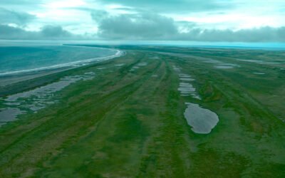
Tugidak Island, Trinity Island Group
Tugidak Island is the westernmost of the Trinity Island Group, which includes Sitkinak Island, and is part of the Kodiak Archipelago situated off the southern tip of Kodiak Island in the Gulf of Alaska, about 145 miles (233 km) east of Chignik and 124 miles (200 km) south-southwest of Kodiak, Alaska.
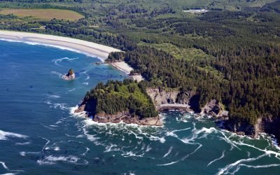
Portage Head, Makah Bay
Portage Head is a prominent headland south of Cape Flattery on the Olympic Peninsula that separates Makah Bay Beach from Shi Shi Beach, about 58 miles (94 km) west-northwest of Port Angeles and 6 miles (10 km) southwest of Neah Bay, Washington.
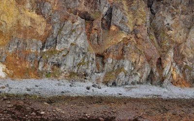
Vindicator Mine, Popof Island
Vindicator is a historical beach placer mine in the Alaska Peninsula Mining District situated on the western shore of Popof Island between Sand Point to the north and Red Cove to the south, about 260 miles (419 km) northeast of Dutch Harbor and 67 miles (108 km) southwest of Perryville, Alaska.
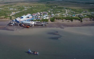
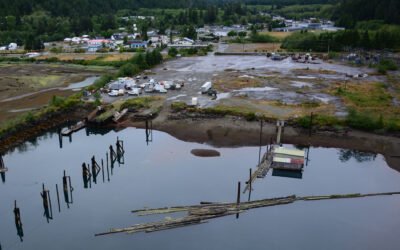
Diamond NN Cannery, South Naknek
Diamond NN is a historic cannery in South Naknek at the mouth of the Naknek River that flows into Kvichak Bay, an arm of Bristol Bay, about 56 miles (90 km) southeast of Dillingham and 13 miles (21 km) west of King Salmon, Alaska.
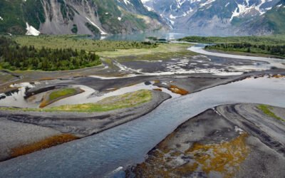
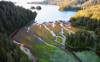
Pedersen Lagoon, Aialik Bay
Pedersen Lagoon receives freshwater from proglacial lakes of the Addison and Pedersen glaciers that descend from the Harding Icefield in Kenai Fjords National Park on the western shore of Aialik Bay, about 64 miles (103 km) east-northeast of Homer and 19 miles (31 km) south-southwest of Seward, Alaska.