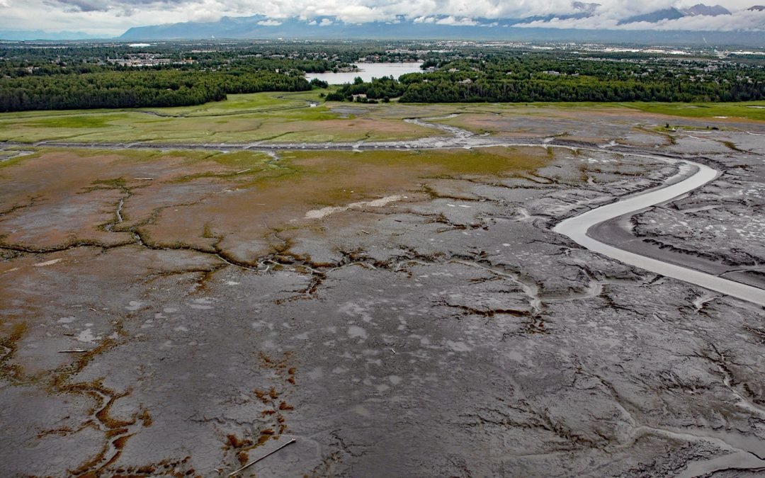
by CoastView | Jan 11, 2024 | 2024, Alaska, Biodiversity, Coastal Features, Developments, Land Use, Natural History, Rivers
Campbell Creek starts at the confluence of the North and South forks in Campbell Park on the western flank of the Chugach Mountains and flows generally southwest for 10 miles (16 km) through the city of Anchorage to Campbell Lake, and the lake outflow then enters...
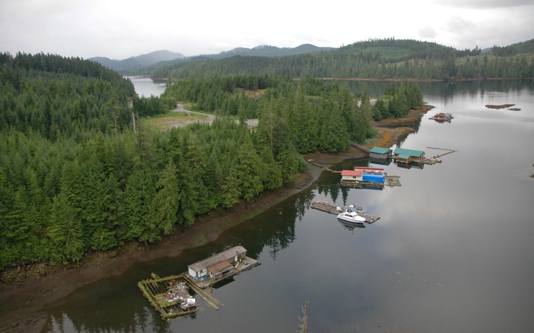
by CoastView | Jan 10, 2024 | 2024, Alaska, Biodiversity, Coastal Features, Communities, Developments, Embayments, Islands, Land Use, Natural History
Naukati Bay is a community at the site of a former logging camp and log transfer facility situated on a peninsula on the western coast of Prince of Wales Island between Little Naukati Bay to the northwest, Kaikli Cove to the northeast, Naukati Bay to the east, and...

by CoastView | Jan 9, 2024 | 2024, Alaska, Canneries, Communities, Developments, Islands, Land Use, Mines
Calder is a mining camp for a historic marble quarry and present-day limestone mine situated at the mouth of Marble Creek on Shakan Strait near the entrance to El Capitan Passage on Prince of Wales Island, about 92 miles (148 km) northwest of Ketchikan and 12 miles...

by CoastView | Jan 8, 2024 | 2024, Alaska, Beaches, Biodiversity, Coastal Features, Communities, Embayments, Land Use, Mines, Natural History, Rivers
Deering is a community situated on a barrier spit at the mouth of the Inmachuk River on Kotzebue Sound on the northern coast of the Seward Peninsula between Cape Deceit to the west and Ninemile Point to the east, about 155 miles (250 km) east-northeast of Point Hope...

by CoastView | Jan 7, 2024 | 2024, Alaska, Climate Change, Coastal Features, Glaciers, Natural History, Parks, Rivers
Fourpeaked Glacier starts from the eastern flank of Fourpeaked Mountain with a summit elevation of 6771 feet (2,064 m) and flows generally east for 6 miles (10 km) to a proglacial lake about 2.5 miles (4 km) long that is drained by a river that flows another 0.8 miles...

by CoastView | Jan 6, 2024 | 2024, Beaches, Biodiversity, California, Coastal Features, Developments, Embayments, Land Use, Natural History
Lawson’s Landing is a recreational area and campground on 75 acres (30 ha) in the Tomales Dunes Complex on Tomales Bay at Sand Point, about 20 miles (32 km) southwest of Santa Rosa and 1 mile (1.6 km) south of Dillion Beach, California. The landing is named after the...