by CoastView | Feb 11, 2025 | 2025, Alaska, Beaches, Biodiversity, Coastal Features, Headlands, Natural History
Listen to the article here https://coastview.org/wp-content/uploads/2025/03/Lewis.mp3 Cape Lewis is a 1,222-foot (372 m) promontory with steep sea cliffs situated between Ukinyak Creek to the north and Kiliktakgot Creek to the south, 11 miles (18 km) south of Cape...
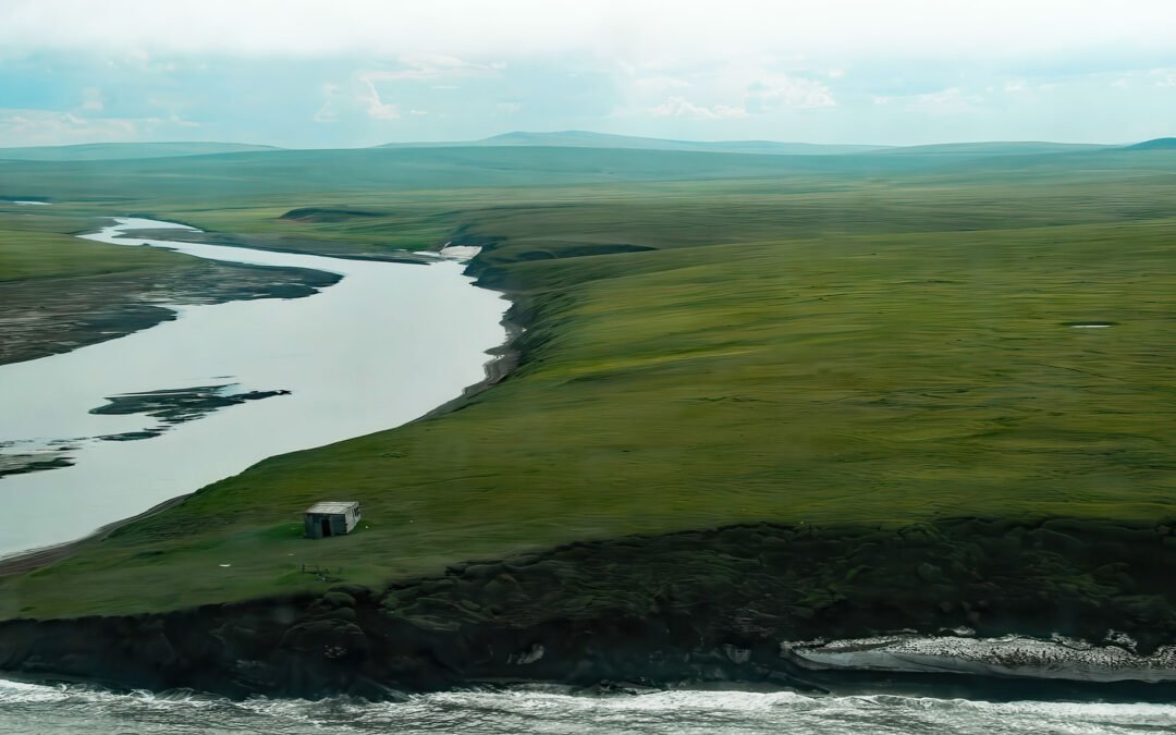
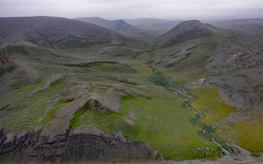
by CoastView | Feb 8, 2025 | 2025, Alaska, Beaches, Coastal Features, Historical, Mines, Rivers, Shelter Cabins
Listen to the article here https://coastview.org/wp-content/uploads/2025/03/Pitmegea.mp3 The Pitmegea River originates at an elevation of about 1,300 feet (396 m) in the De Long Mountains of the western Brooks Range, and flows northwest for 37 miles (60 km) to the...
by CoastView | Feb 4, 2025 | 2025, Beaches, Biodiversity, California, Climate Change, Coastal Features, Embayments, Historical, Land Use, Parks, Rivers
Listen to the article here https://coastview.org/wp-content/uploads/2025/03/Jug-Handle-Cove.mp3 Jug Handle Cove is a California State Natural Preserve made up of a series of ancient marine terraces, known as the Ecological Staircase, which exhibit different stages of...
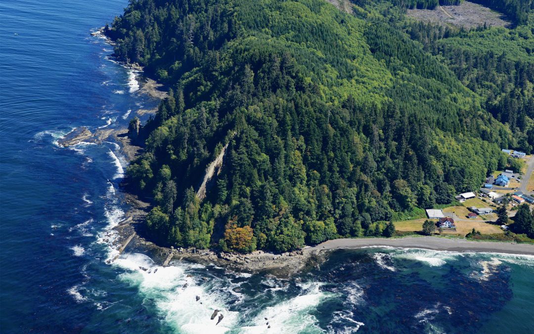
by CoastView | Feb 2, 2025 | 2025, Beaches, Biodiversity, Coastal Features, Communities, Embayments, Headlands, Historical, Land Use, Lighthouses, Mines, Rivers, Washington
Listen to the article here https://coastview.org/wp-content/uploads/2025/03/Slip-Point.mp3 Slip Point sits on the southern shore of the Strait of Juan de Fuca at the eastern end of Clallam Bay on the Olympic Peninsula, about 39 miles (63 km) west-northwest of Port...

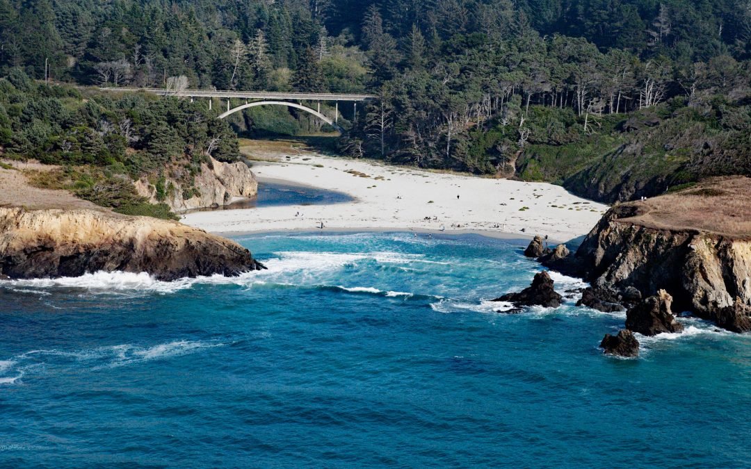
by CoastView | Jan 29, 2025 | 2025, Beaches, Biodiversity, California, Chemical Pollution, Coastal Features, Communities, Developments, Freshwater, Historical, Land Use, Parks
Listen to the article here https://coastview.org/wp-content/uploads/2025/03/Lobos-1.mp3 Lobos Creek is a stream in the Presidio of San Francisco, draining urban runoff and underground springs and flowing intermittently west for 1 mile (1.6 km) from near Mountain Lake...
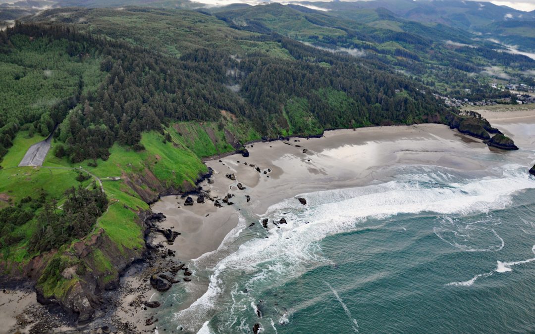
by CoastView | Jan 27, 2025 | 2025, Beaches, Biodiversity, Climate Change, Coastal Features, Headlands, Historical, Land Use, Oregon, Parks
Listen to the article here https://coastview.org/wp-content/uploads/2025/03/Ecola.mp3 Crescent Beach lies between Ecola Point and Chapman Point in Ecola State Park, about 20 miles (32 km) south-southwest of Astoria and 2 miles (3.2 km) north-northwest of Cannon Beach,...