
by CoastView | Jun 2, 2026 | 2026, Alaska, Chemical Pollution, Communities, Developments, Embayments, Historical, Islands, June 2026, Land Use, Mines, Natural History
Listen to the article here https://coastview.org/wp-content/uploads/2026/02/LaToucheIsland.mp3 The Beatson Copper Mine and the abandoned mining community of Latouche sit at the base of Mount Beatson, near Powder Point at the northwest tip of Latouche Island in Prince...

by CoastView | Jan 4, 2026 | 2026, Alaska, Chemical Pollution, Coastal Features, Developments, January 2026, Land Use, Mines
Listen to the article here https://coastview.org/wp-content/uploads/2025/12/RedDogMine.mp3 Red Dog is a zinc and lead mine located about 46 miles (74 km) inland from the Chukchi Sea coast in the DeLong Mountains, approximately 62 miles (100 km) northwest of Kotzebue...
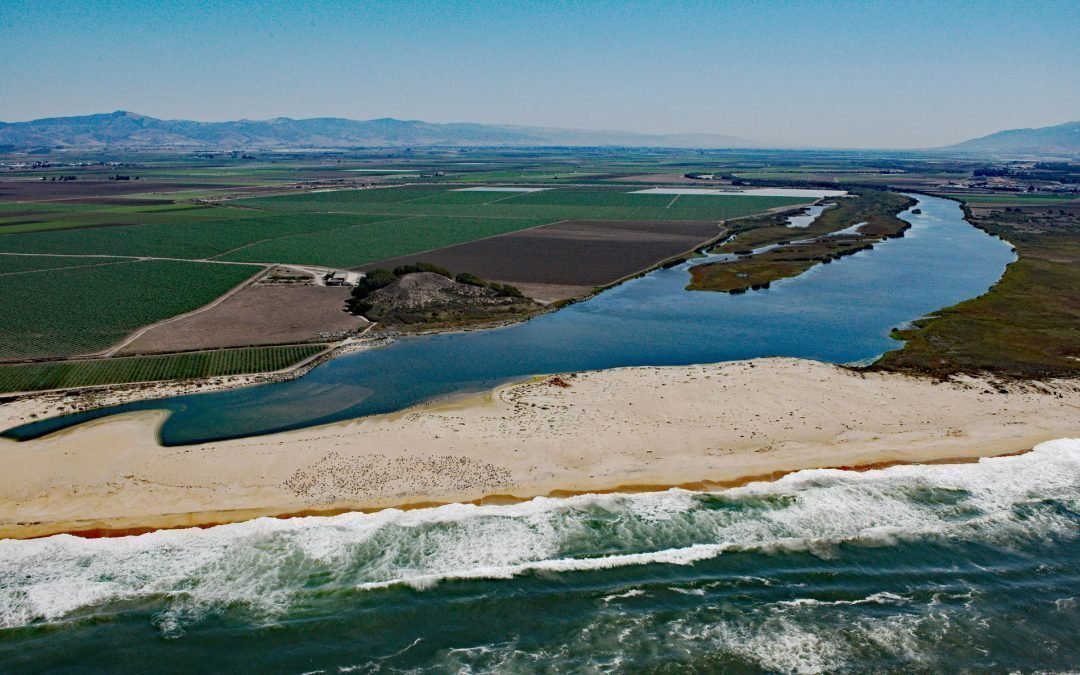
by CoastView | Jul 29, 2025 | 2025, Beaches, Biodiversity, California, Chemical Pollution, Coastal Features, Freshwater, Historical, Land Use, Natural History, Rivers
Listen to the article here https://coastview.org/wp-content/uploads/2025/06/Salinas-River.mp3 The Salinas River begins in the central California Coast Ranges and flows 175 miles (282 km) generally northwest to Monterey Bay, approximately 12 miles (19 km)...

by CoastView | Jun 3, 2025 | 2025, Alaska, Chemical Pollution, Climate Change, Coastal Features, Developments, Historical, Land Use, Natural History
Listen to the article here https://coastview.org/wp-content/uploads/2025/05/Point-Lonely.mp3 Originally a Cold War Distant Early Warning facility, Lonely was decommissioned in 2018 and is now an unattended airstrip on the Beaufort Sea coast at Pitt Point, about 83...

by CoastView | May 26, 2025 | 2025, Alaska, Beaches, Biodiversity, Canneries, Chemical Pollution, Developments, Embayments, Historical, Islands, Land Use
Listen to the article here https://coastview.org/wp-content/uploads/2025/04/Port-OBrien.mp3 Port O’Brien is a remote salmon cannery on the eastern shore of Northeast Arm, Uganik Bay, located on the northwest coast of Kodiak Island, about 147 miles (236 km)...

by CoastView | May 19, 2025 | 2025, Alaska, Biodiversity, Canneries, Chemical Pollution, Coastal Features, Developments, Embayments, Historical, Islands, Land Use
Listen to the article here https://coastview.org/wp-content/uploads/2025/04/Port-Bailey.mp3 Port Bailey is a historic cannery located in Dry Spruce Bay on the Kupreanof Peninsula of Kodiak Island, approximately 130 miles (209 km) south-southwest of Homer and 26 miles...