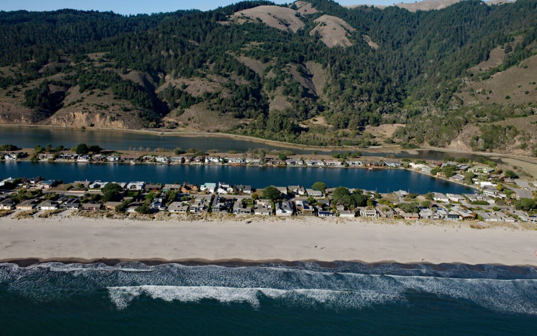
by CoastView | Mar 10, 2024 | 2024, Beaches, California, Climate Change, Coastal Features, Communities, Developments, Embayments, Land Use, Natural History
Stinson Beach is a community on Bolinas Bay developed on a crescent-shaped sand spit partially enclosing Bolinas Lagoon between Duxbury Point to the northwest and Rocky Point to the south, about 15 miles (24 km) northwest of San Francisco and 14 miles (23 km)...
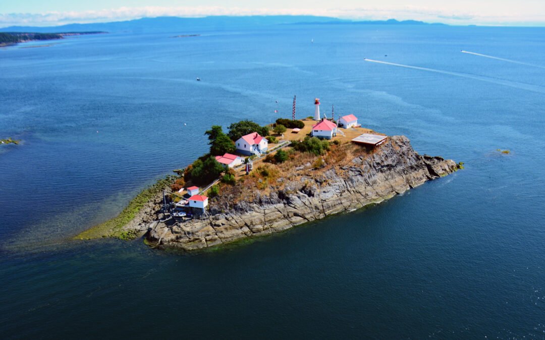
by CoastView | Mar 6, 2024 | 2024, British Columbia, Coastal Features, Developments, Embayments, Islands, Land Use, Lighthouses, Natural History
Chrome Island is located 0.15 miles (0.24 km) south of Boyle Point Provincial Park, on the southern tip of Denman Island, and is the site of a historic lighthouse that marks the southern entrance to Baynes Sound, about 72 miles (116 km) west-northwest of Vancouver and...
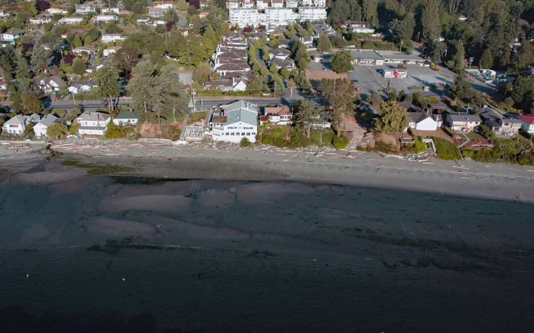
by CoastView | Mar 3, 2024 | 2024, Beaches, Biodiversity, British Columbia, Communities, Developments, Embayments, Islands, Land Use, Natural History
Cordova Bay is a shallow bight and a community located on the eastern shore of the Saanich Peninsula in the municipality of Saanich, one of the 13 cities comprising the Greater Victoria Region on Vancouver Island, about 9 miles (14.5 km) south-southeast of Sidney and...

by CoastView | Mar 2, 2024 | 2024, British Columbia, Coastal Features, Developments, Headlands, Islands, Land Use, Lighthouses, Natural History
Langara is the northernmost island of the Haida Gwaii archipelago and the site of a historic light station that marks the southern boundary of Dixon Entrance, about 94 miles (151 km) southwest of Ketchikan, Alaska and 38 miles (61 km) west-northwest of Masset, British...
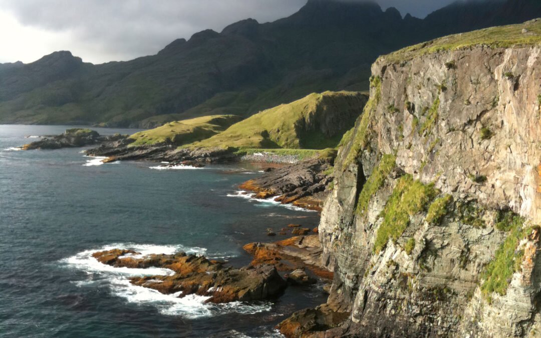
by CoastView | Mar 1, 2024 | 2024, Alaska, Biodiversity, Coastal Features, Developments, Embayments, Islands, Land Use, Natural History
Boot Bay is 3 miles (5 km) west of Kagalaska Strait on the south coast of Adak Island, the site of intensive military activity from 1942 to 1997, near the western extent of the Andreanof Islands group of the Aleutian Islands, about 443 miles (713 km) southwest of...

by CoastView | Feb 25, 2024 | 2024, Biodiversity, British Columbia, Coastal Features, Developments, Land Use, Natural History, Rivers
Scotia River starts at an elevation of 5,023 feet (1,531 m) in the Coast Range and flows generally north-northwest for 14 miles (22 km) through the Great Bear Rainforest, draining a watershed of 33,360 acres (13,500 ha) to the southern shore, or left bank, of the...
