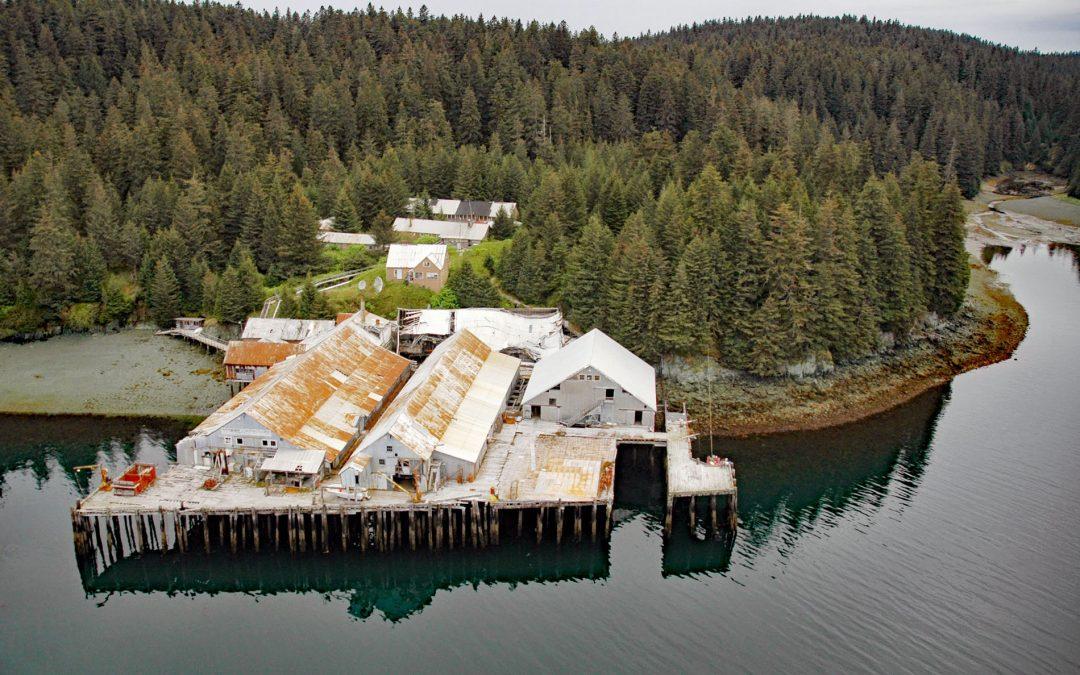
by CoastView | Mar 3, 2026 | 2026, Alaska, Biodiversity, Canneries, Embayments, March 2026, Natural History
Listen to the article here https://coastview.org/wp-content/uploads/2026/01/PortWilliam.mp3 Port William is a historical salmon cannery in an embayment on the southern coast of Shuyak Island that extends 0.5 miles (0.8 km) north from Shuyak Strait, between Port...
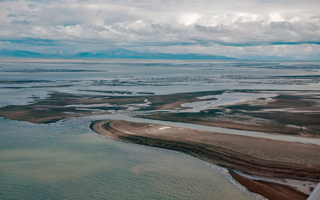
by CoastView | Mar 1, 2026 | 2026, Alaska, Communities, Embayments, Historical, Land Use, March 2026, Natural History
Listen to the article here https://coastview.org/wp-content/uploads/2026/01/PortHeiden.mp3 Port Heiden is an embayment on the northern coast of the Alaska Peninsula that extends 9 miles (14 km) south-east from Bristol Bay between Strogonof Point and the community of...

by CoastView | Feb 27, 2026 | 2026, Alaska, Beaches, Biodiversity, Coastal Features, Embayments, February 2026, Kachemak, Land Use, Parks, Rivers
Listen to the article here https://coastview.org/wp-content/uploads/2026/01/GrewingkCreek.mp3 Grewingk Creek drains a glaciated watershed of 29,138 acres (11,792 ha) and flows northwest for 3.5 miles (5.6 km) from the terminus lake of the retreating Grewingk Glacier...

by CoastView | Feb 26, 2026 | 2026, Best of 2025, British Columbia, Developments, Embayments, February 2026, Land Use, Mines, Natural History
Listen to the article here https://coastview.org/wp-content/uploads/2026/01/IslandCopperMine.mp3 Island Copper was an open pit mine at the northern end of Vancouver Island on Rupert Inlet at the head of Quatsino Sound, about 4.6 miles (7.4 km) east of Coal Harbour and...

by CoastView | Feb 25, 2026 | 2026, Alaska, Coastal Features, Embayments, February 2026, Historical, Natural History, Parks
Listen to the article here https://coastview.org/wp-content/uploads/2026/01/LituyaBay.mp3 Lituya Bay is a fjord on the outer coast of Southeast Alaska in Glacier Bay National Park and Preserve, about 97 miles (156 km) south-east of Yakutat and 70 miles (113 km)...

by CoastView | Feb 24, 2026 | 2026, Alaska, Coastal Features, Developments, Embayments, February 2026, Islands, Land Use, Rivers
Listen to the article here https://coastview.org/wp-content/uploads/2026/01/TerrorBay.mp3 Terror Bay lies on Kodiak Island’s northern coast and extends about 7 miles (11 km) south from Uganik Passage to the mouth of Terror River in Kodiak National Wildlife...