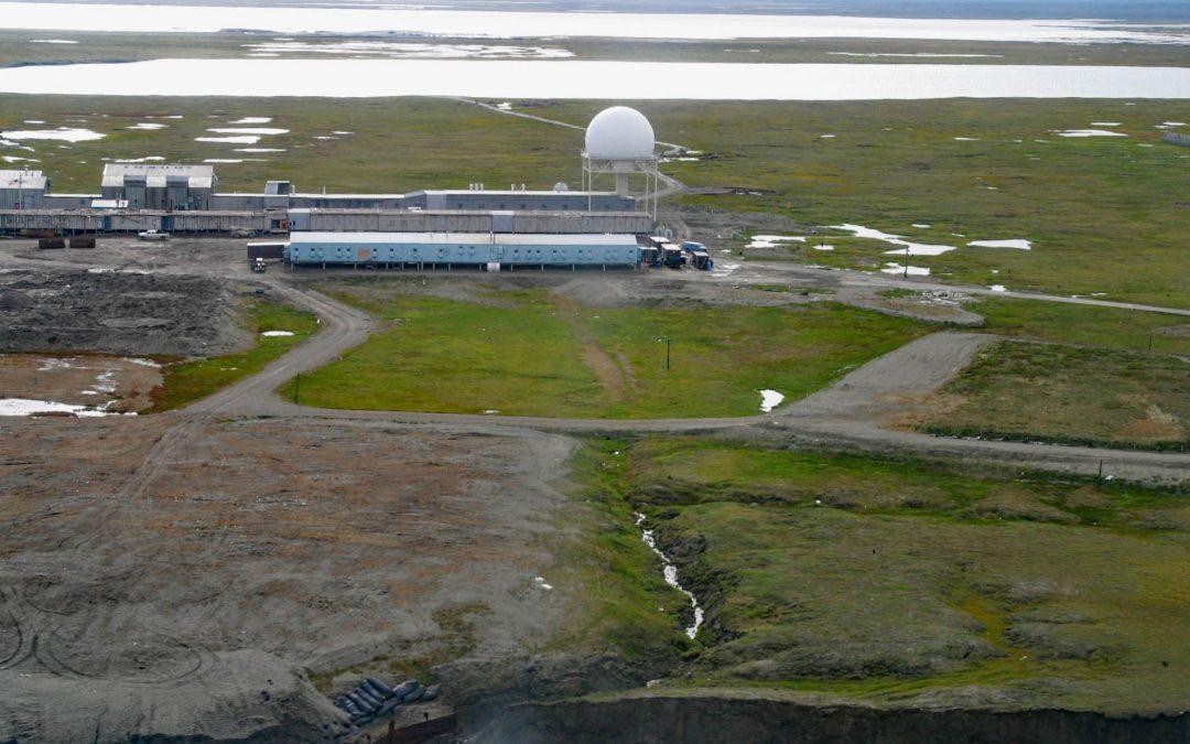
by CoastView | May 7, 2023 | 2026, Alaska, Climate Change, Communities, Developments, Islands, Land Use, May 2026, Natural History
Listen to the article here https://coastview.org/wp-content/uploads/2026/01/BarterIsland.mp3 The North Warning System station at Barter Island is a long-range radar facility on the Beaufort Sea coast adjacent to the village of Kaktovik, about 273 miles (440 km)...
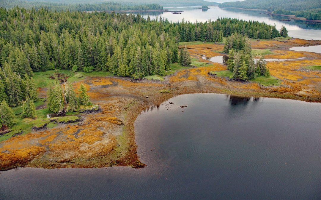
by CoastView | May 6, 2023 | 2026, Alaska, Biodiversity, Coastal Features, Communities, Embayments, Islands, Land Use, May 2026, Natural History
Listen to the article here https://coastview.org/wp-content/uploads/2026/01/WhalePass.mp3 Whale Passage is a waterway about 10 miles (16 km) long situated between Thorne Island to the east and Prince of Wales Island to the west, roughly 40 miles (65 km) southwest of...
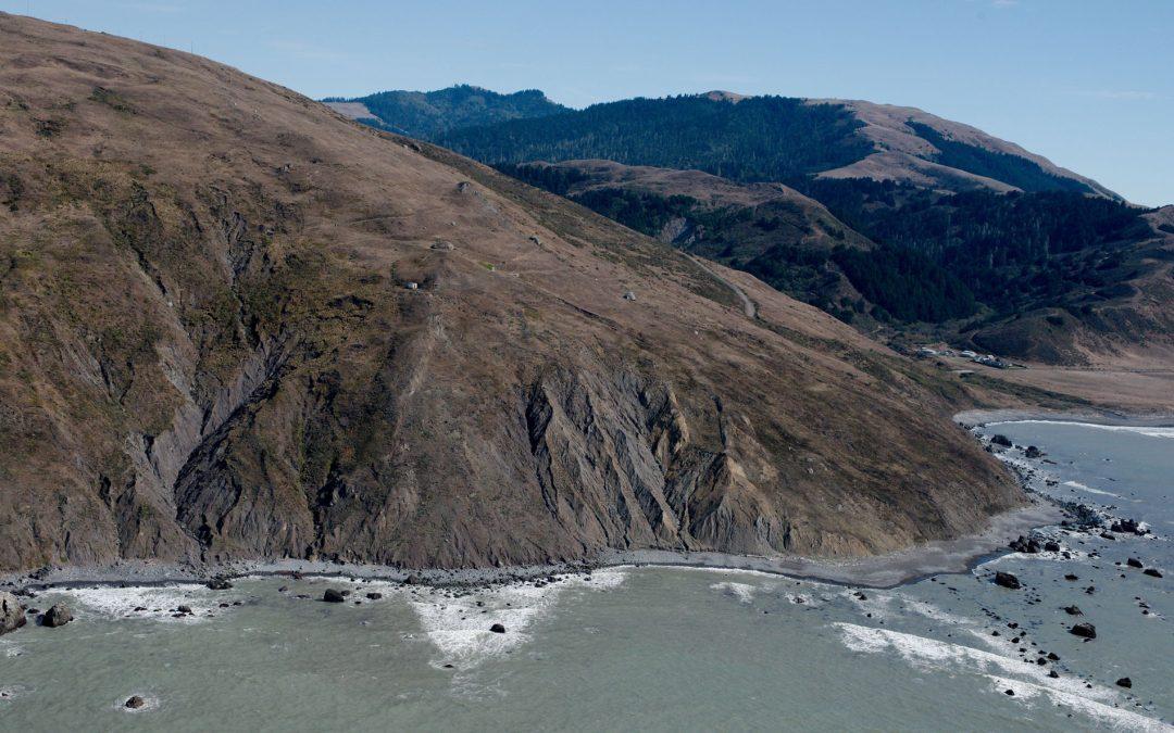
by CoastView | May 5, 2023 | 2026, California, Coastal Features, Headlands, Land Use, Lighthouses, May 2026, Natural History
Listen to the article here https://coastview.org/wp-content/uploads/2026/01/CapeMendocino.mp3 Cape Mendocino is a major headland on the Lost Coast, situated between the Bear river to the north and Mattole river to the south, about 210 miles (338 km) north-west of San...
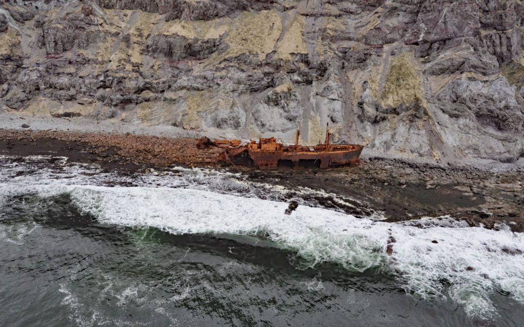
by CoastView | May 4, 2023 | 2026, Alaska, Coastal Features, Historical, Islands, May 2026, Natural History, Shipwrecks
Listen to the article here https://coastview.org/wp-content/uploads/2026/01/SSOduna.mp3 Cape Pankof is a point of land at the eastern tip of the Ikatan Peninsula on Unimak Island, about 148 miles (239 km) north-east of Dutch Harbor and 18 miles (29 km) southeast of...

by CoastView | May 3, 2023 | 2026, Alaska, Embayments, Kachemak, May 2026, Natural History, Parks, Rivers
Listen to the article here https://coastview.org/wp-content/uploads/2026/01/McKeonFlats.mp3 McKeon Flats is formed by the Wosnesenski River, which flows into Neptune Bay on the south shore of Kachemak Bay on the Kenai Peninsula, about 14 miles (23 km) north-east of...

by CoastView | May 2, 2023 | 2026, Beaches, Communities, Land Use, May 2026, Natural History, Oregon, Rivers, Shipwrecks
Listen to the article here https://coastview.org/wp-content/uploads/2026/01/SiuslawRiver.mp3 The Siuslaw River flows generally west-northwest for 110 miles (177 km) to the Pacific Ocean at Florence, about 53 miles (85 km) west of Eugene and 43 miles (69 km) south of...