
by CoastView | Jan 31, 2024 | 2024, British Columbia, Embayments, Land Use, Natural History, Parks, Rivers
Kitlope River starts from the Kitimat Ranges and flows generally northwest to the head of Gardner Canal, about 125 miles (202 km) southeast of Prince Rupert and 75 miles (121 km) north of Bella Bella, British Columbia. The Kitlope Valley and the river are named for...

by CoastView | Jan 18, 2024 | 2024, Alaska, Coastal Features, Communities, Developments, Embayments, Land Use, Mines, Natural History, Rivers
Valdez is a community situated on the outwash fan of Mineral Creek on the north shore and near the head of Port Valdez in northeastern Prince William Sound, about 82 miles (132 km) east-northeast of Whittier and 46 miles (74 km) north-northwest of Cordova, Alaska....
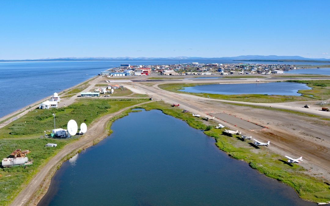
by CoastView | Jan 17, 2024 | 2024, Alaska, Beaches, Biodiversity, Coastal Features, Communities, Embayments, Land Use, Natural History, Rivers
Kotzebue is a community situated between Cape Blossom to the south and Pipe Spit to the east near the tip of the Baldwin Peninsula that separates Kotzebue Sound from Hotham Inlet, about 149 miles (240 km) southeast of Point Hope and 73 miles (117 km) west-northwest of...
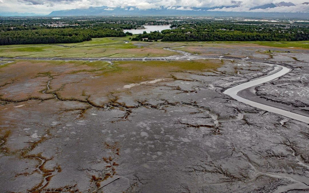
by CoastView | Jan 11, 2024 | 2024, Alaska, Biodiversity, Coastal Features, Developments, Land Use, Natural History, Rivers
Campbell Creek starts at the confluence of the North and South forks in Campbell Park on the western flank of the Chugach Mountains and flows generally southwest for 10 miles (16 km) through the city of Anchorage to Campbell Lake, and the lake outflow then enters...

by CoastView | Jan 8, 2024 | 2024, Alaska, Beaches, Biodiversity, Coastal Features, Communities, Embayments, Land Use, Mines, Natural History, Rivers
Deering is a community situated on a barrier spit at the mouth of the Inmachuk River on Kotzebue Sound on the northern coast of the Seward Peninsula between Cape Deceit to the west and Ninemile Point to the east, about 155 miles (250 km) east-northeast of Point Hope...

by CoastView | Jan 7, 2024 | 2024, Alaska, Climate Change, Coastal Features, Glaciers, Natural History, Parks, Rivers
Fourpeaked Glacier starts from the eastern flank of Fourpeaked Mountain with a summit elevation of 6771 feet (2,064 m) and flows generally east for 6 miles (10 km) to a proglacial lake about 2.5 miles (4 km) long that is drained by a river that flows another 0.8 miles...