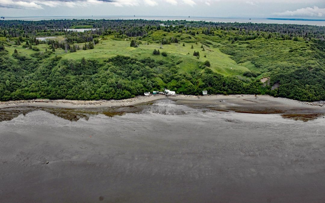
by CoastView | Nov 15, 2023 | 2023, Alaska, Beaches, Best of 2023, Coastal Features, Developments, Headlands, Historical, Land Use, Natural History, Rivers
Kustatan is a historical Dena’ina community on West Foreland, on the west side of Cook Inlet near the mouth of the Kustatan River, about 71 miles (115 km) southwest of Anchorage and 20 miles (32 km) northwest of Kenai, Alaska. The last syllable ‘tan’...
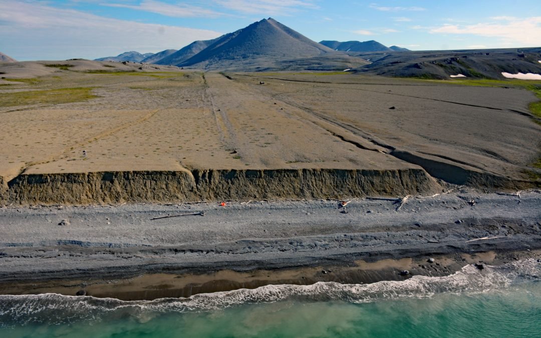
by CoastView | Nov 13, 2023 | 2023, Alaska, Beaches, Coastal Features, Developments, Historical, Land Use, Mines, Natural History, Rivers
Lost River starts at an elevation of 1400 feet (427 m) on the south flank of the York Mountains on the Seward Peninsula and flows south for 9.5 miles (15 km) to the Bering Sea, about 86 miles (138 km) northwest of Nome and 31 miles (50 km) southeast of Wales, Alaska....
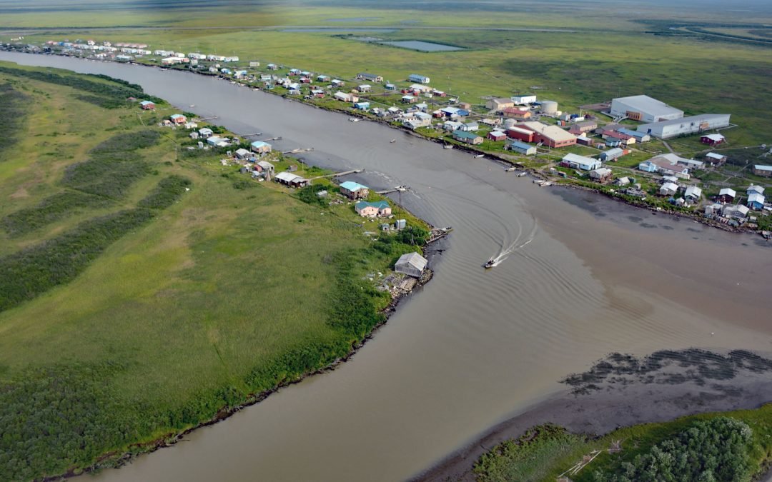
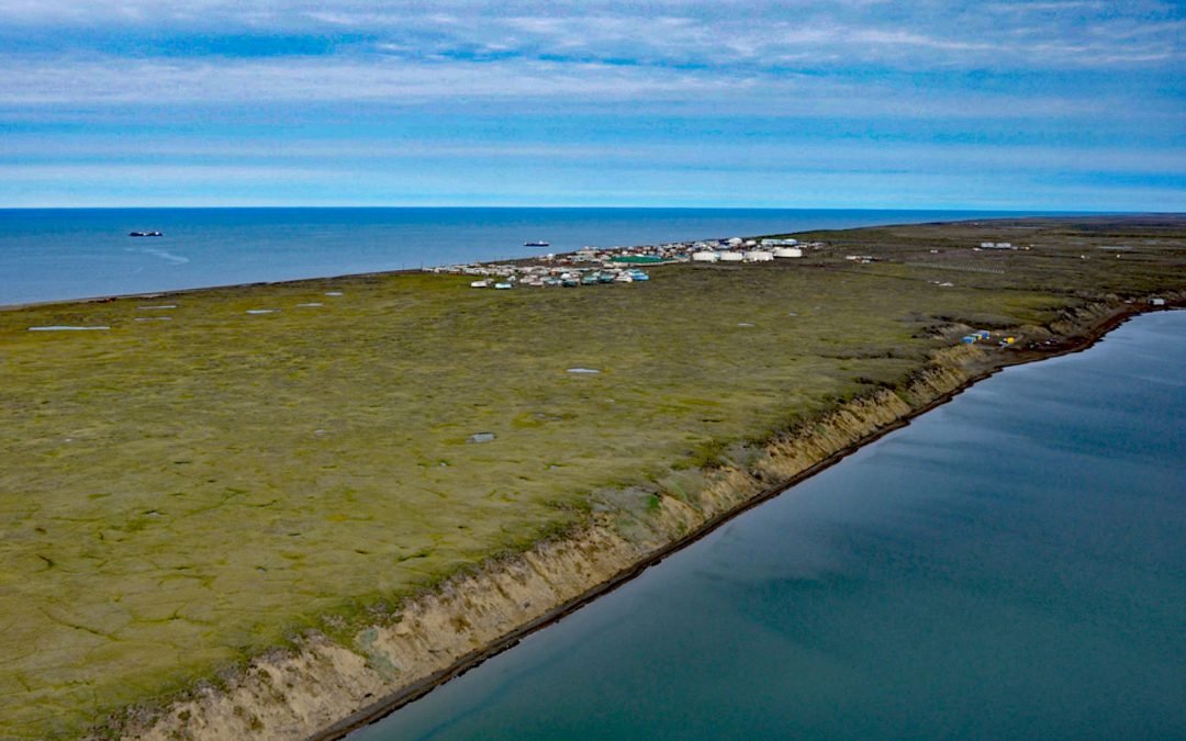
by CoastView | Nov 6, 2023 | 2023, Alaska, Communities, Developments, Land Use, Natural History, Rivers
Kotlik is a Yup’ik community situated on Kotlik Slough, a side channel of Apoon Pass formed by the confluence of the Kotlik and Little Kotlik River in the Yukon River Delta, 6 miles (10 km) inland from Pastol Bay on the southern coast of Norton Sound, about 116...

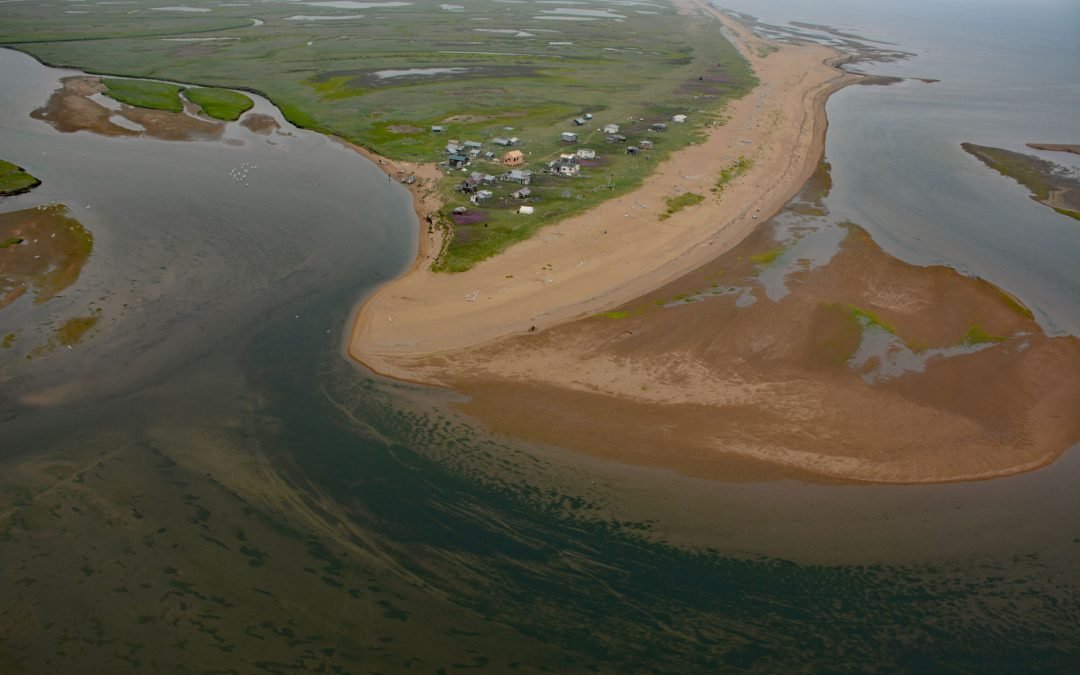
by CoastView | Nov 3, 2023 | 2023, Alaska, Climate Change, Coastal Features, Communities, Land Use, Natural History, Rivers
Quinhagak, or Kwinhagak, is a Central Yup’ik community situated on the Yukon-Kuskokwim Delta near the mouth of the Kanektok River, about 73 miles (118 km) south of Bethel and 45 miles (72 km) north of Goodnews Bay, Alaska. The name is anglicized from the...
by CoastView | Nov 1, 2023 | 2023, Alaska, Beaches, Biodiversity, Coastal Features, Communities, Embayments, Land Use, Natural History, Rivers
Moses Point is a fish camp, used mostly by residents of Elim, situated at the mouth of the Kwiniuk River on the northern shore of Norton Bay, about 100 miles (160 km) east of Nome and 31 miles (50 km) southwest of Koyuk, Alaska. The name Moses Point also refers to a...
by CoastView | Oct 27, 2023 | 2023, Alaska, Beaches, Biodiversity, Climate Change, Communities, Developments, Embayments, Land Use, Natural History, Rivers
Wainwright is an Iñupiat community on the Chukchi Sea coastline situated on a barrier beach adjacent to Wainwright Inlet and the Kuk River, about 94 miles (151 km) northeast of Point Lay and 86 miles (138 km) southwest of Utqiaġvik, Alaska. The inlet is also known as...