by CoastView | Mar 20, 2024 | 2024, Alaska, Beaches, Climate Change, Coastal Features, Embayments, Glaciers, Land Use, Natural History, Parks
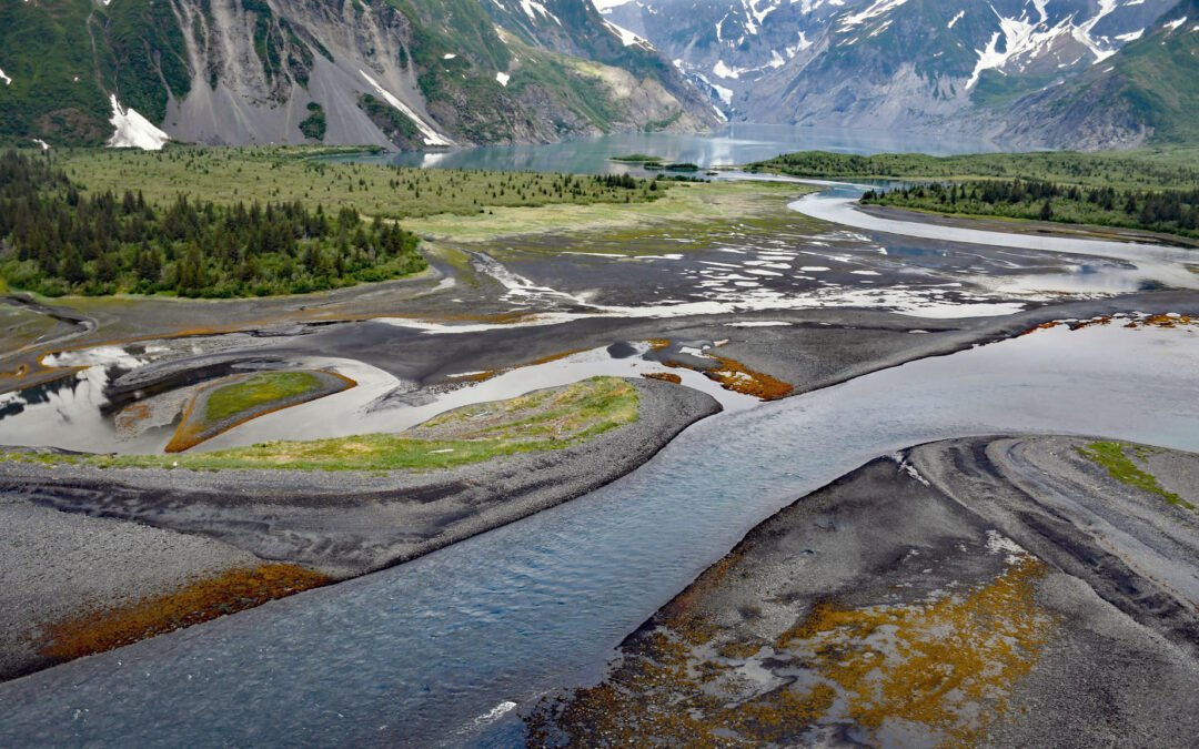
Pedersen Lagoon receives freshwater from proglacial lakes of the Addison and Pedersen glaciers that descend from the Harding Icefield in Kenai Fjords National Park on the western shore of Aialik Bay, about 64 miles (103 km) east-northeast of Homer and 19 miles (31 km)...
by CoastView | Mar 19, 2024 | 2024, British Columbia, Coastal Features, Developments, Headlands, Islands, Land Use, Lighthouses, Natural History, Parks
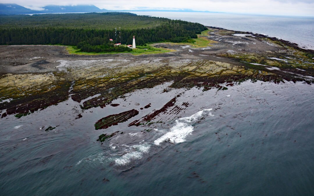
Estevan Point is the site of a historic lighthouse at the end of the Hesquiat Peninsula which forms the southern entrance to Nootka Sound on the west coast of Vancouver Island, about 35 miles (56 km) southwest of Gold River and 33 miles (53 km) northwest of Tofino,...
by CoastView | Mar 17, 2024 | 2024, Beaches, Biodiversity, California, Coastal Features, Embayments, Headlands, Historical, Land Use, Natural History, Parks
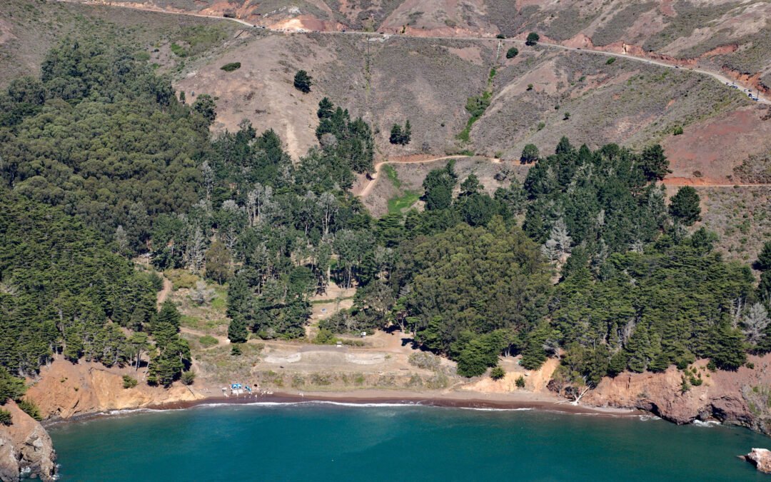
Kirby Cove is an embayment in the Marin Headlands on the northern shore of the Golden Gate in the Golden Gate National Recreation Area, and the site of a historic military installation, about 5.5 miles (9 km) northwest of downtown San Francisco and 2.3 miles (4 km)...
by CoastView | Mar 15, 2024 | 2024, Beaches, Coastal Features, Headlands, Land Use, Mines, Natural History, Oregon, Parks
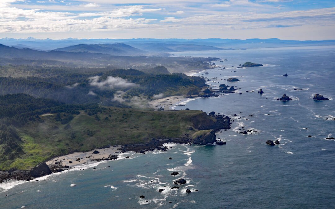
Lone Ranch Beach is a sand and gravel deposit at Cape Ferrelo situated between Lone Ranch Creek to the north and Ram Creek to the south in Samuel H. Boardman State Scenic Corridor, about 22 miles (35 km) south of Gold Beach and 5 miles (8 km) northwest of Brookings,...

by CoastView | Mar 13, 2024 | 2024, Alaska, Biodiversity, Coastal Features, Embayments, Glaciers, Natural History, Parks
Gilman Glacier starts at an elevation of roughly 6,000 feet (1,828 m)in the Fairweather Range of the Saint Elias Mountains and flows generally northwest for 7.5 miles (12 km) to Johns Hopkins Inlet in Glacier Bay National Park and Preserve, about 105 miles (169 km)...

by CoastView | Mar 9, 2024 | 2024, Beaches, Biodiversity, Coastal Features, Embayments, Land Use, Natural History, Oregon, Parks
Netarts Spit is in Cape Lookout State Park and extends north for 6 miles (10 km) from Cape Lookout, forming Netarts Bay, an estuary of 2,179 acres (883 ha) for several minor streams draining the western flank of an unnamed peninsula separating Tillamook Bay from the...