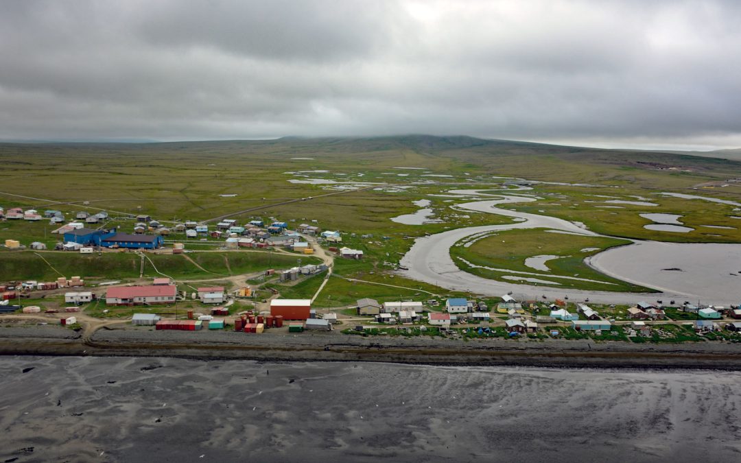
by CoastView | Dec 8, 2023 | 2023, Alaska, Beaches, Biodiversity, Coastal Features, Communities, Embayments, Islands, Land Use, Natural History, Rivers
Tununak is a traditional Central Yup’ik community located on the northwest coast of Nelson Island on a narrow barrier spit between the Bering Sea and the mouth of the Tununak River, about 119 miles (192 km) west-southwest of Bethel and 71 miles (114 km)...

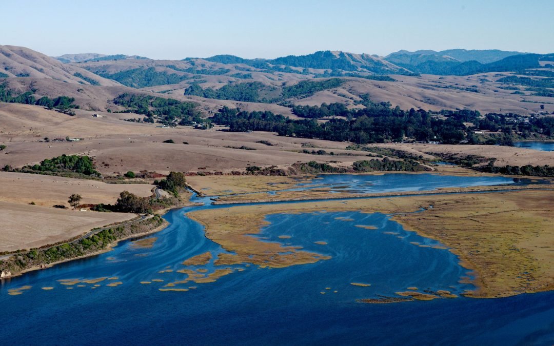
by CoastView | Dec 7, 2023 | 2023, Beaches, Biodiversity, Coastal Features, Embayments, Islands, Land Use, Natural History, Oregon, Parks, Rivers
Whalen Island is located in Sand Lake which is the estuary of Sand Creek that starts at an elevation of 770 feet (235 m) in the Oregon Coast Range and flows generally south-southwest for 8 miles (13 km) to the Pacific Ocean draining a watershed of 10,880 acres (4,403...

by CoastView | Dec 5, 2023 | 2023, Alaska, Biodiversity, Climate Change, Communities, Embayments, Land Use, Natural History, Rivers
Koyuk is an Iñupiaq community situated at the head of Norton Bay on the right bank of the Koyuk River estuary on the Seward Peninsula, about 129 miles (208 km) east-northeast of Nome and 40 miles (64 km) north of Shaktoolik, Alaska. The village was first reported in...

by CoastView | Dec 3, 2023 | 2023, Alaska, Best of 2023, Biodiversity, Canneries, Coastal Features, Communities, Embayments, Land Use, Natural History, Rivers
Rolph, or Ralph Slough is a tidal creek in an area of grass meadows and numerous unnamed sloughs that cut through vast mud flats on the left bank near the mouth of the Nushagak River at Nushagak Point, about 55 miles (89 km) west-northwest of Naknek and 6 miles (10...
by CoastView | Dec 2, 2023 | 2023, Biodiversity, Coastal Features, Communities, Embayments, Land Use, Natural History, Rivers
Point Reyes Station is a community situated on the San Andreas Rift Zone at the head of Tomales Bay near the tidal estuary of Lagunitas Creek, about 29 miles (47 km) northwest of San Francisco and 3.5 miles (6 km) southeast of Inverness, California. Point Reyes...
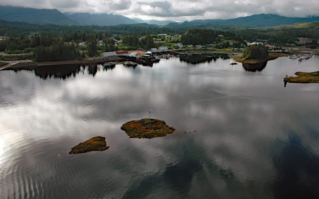
by CoastView | Dec 1, 2023 | 2023, Alaska, Biodiversity, Communities, Embayments, Islands, Land Use, Natural History, Rivers
Klawock is a community on the estuary of the Klawock River on the west coast of Prince of Wales Island in the Alexander Archipelago of Southeast Alaska, about 58 miles (93 km) northwest of Ketchikan and 6 miles (10 km) northeast of Craig, Alaska. The Klawock River...