
by CoastView | Jun 19, 2024 | 2024, Alaska, Coastal Features, Developments, Headlands, Historical, Lighthouses, Shipwrecks
The Scotch Cap Light is located on the southwest corner of Unimak Island, and the eastern shore of Unimak Pass, about 714 miles (1151 km) southwest of Anchorage and 81 miles (131 km) northeast of Dutch Harbor, Alaska. The light provides a navigational aid at the...

by CoastView | Jun 14, 2024 | 2024, British Columbia, Developments, Historical, Islands, Lighthouses, Shipwrecks
Triple Island is the site of a large manned light station in Brown Passage, about 83 miles (134 km) south-southeast of Ketchikan and 22 miles (35 km) west-southwest of Prince Rupert, British Columbia. Brown Passage is a deep ocean channel connecting the western...
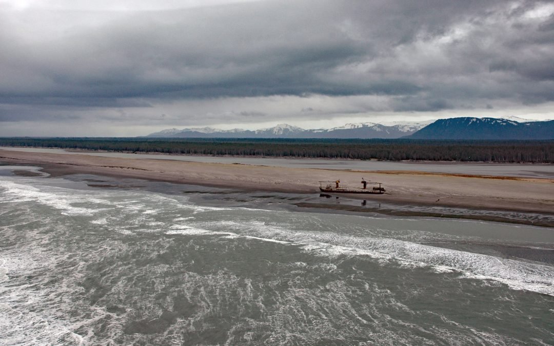
by CoastView | May 27, 2024 | 2024, Alaska, Beaches, Shipwrecks
Kaliakh River drains Hanna Lake and flows generally south through the Malaspina Coastal Plain for 24 miles (39 km) to the Gulf of Alaska, about 13 miles (21 km) northwest of Cape Yakataga and 106 miles (171 km) southeast of Cordova, Alaska. This may be the same stream...

by CoastView | May 11, 2024 | 2024, British Columbia, Islands, Shipwrecks
Seabird Rocks are located near the mouth of Pachena Bay in Pacific Rim National Park Reserve, about 35 miles (56 km) northwest of Port Renfrew and 6 miles (10 km) south of Bamfield, British Columbia. This is where Soquel, a 698-ton four-masted schooner built in San...

by CoastView | May 8, 2024 | 2024, Alaska, Embayments, Shipwrecks
McIver Bight is a cove on the southwestern coast of Unalaska Island, 825 miles (1,330 km) southwest of Anchorage and 38 miles (62 km) southwest of Dutch Harbor, Alaska. The local name was first published in the 1944 Aleutian Coast Pilot. McIver Bight forms the...

by CoastView | May 6, 2024 | 2024, Communities, Embayments, Lighthouses, Oregon, Shipwrecks
Yaquina Bay Light is located on the north shore of the entrance to Yaquina Bay, about 40 miles (65 km) west of Corvallis and 1 mile (1.6 km) southwest of Newport, Oregon. Yaquina Bay is an estuary of the Yaquina River, approximately 2048 acres (829 ha) in area, with a...