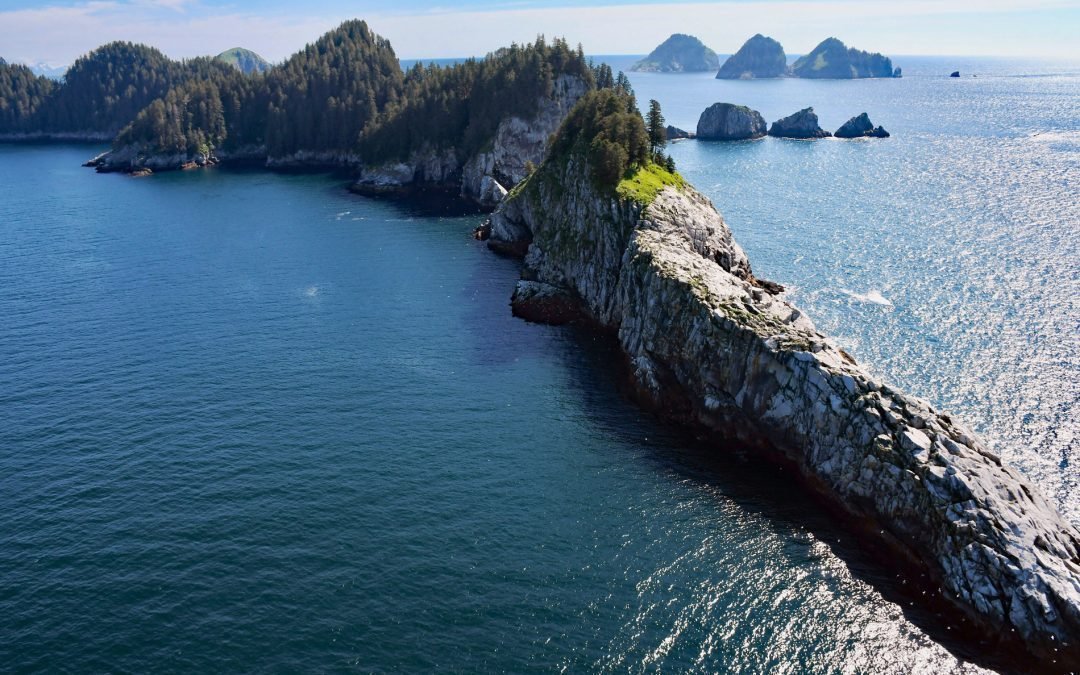
by CoastView | Oct 15, 2024 | 2024, Alaska, Biodiversity, Coastal Features, Islands, Land Use, Natural History, Parks
The Chiswell Islands are a group of rocky and uninhabited islands in the Alaska Maritime National Wildlife Refuge situated at the entrance to Aialik Bay on the south coast of Kenai Fjords National Park, about 67 miles (108 km) east of Homer and 35 miles (56 km) south...
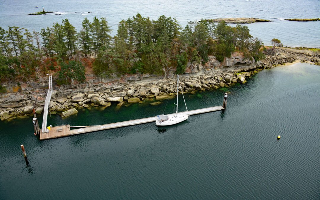
by CoastView | Oct 10, 2024 | 2024, Biodiversity, British Columbia, Coastal Features, Developments, Historical, Islands, Land Use, Parks
Kendrick Island is surrounded by Wakes Cove Provincial Park near the eastern entrance to Gabriola Passage, 0.1 miles (0.2 km) off the northeast coast of Valdes Island, about 28 miles (45 km) southwest of Vancouver and 12 miles (19 km) east-southeast of Nanaimo,...
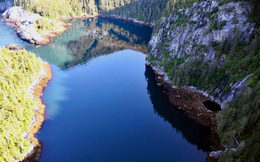
by CoastView | Oct 7, 2024 | 2024, Alaska, Climate Change, Coastal Features, Embayments, Islands, Land Use, Parks, Waterfalls
Taz Basin is a small cove on the west coast of Granite Island, one of the Chiswell Islands on the south coast of Kenai Fjords National Park, about 61 miles (98 km) east of Homer and 34 miles (55 km) south-southwest of Seward, Alaska. The cove is a remarkable natural...
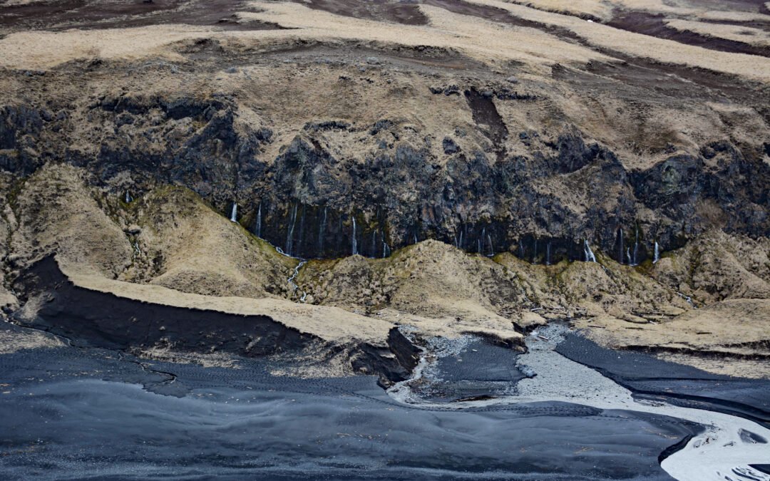
by CoastView | Oct 5, 2024 | 2024, Alaska, Coastal Features, Freshwater, Islands, Waterfalls
The Weeping Wall is a cliff with water seeps on the northwest side of Okmok Volcano on the northeastern part of Umnak Island, one of the Fox Islands in the Eastern Aleutians, about 73 miles (117 km) west-southwest of Dutch Harbor and 49 miles (79 km) north-northeast...
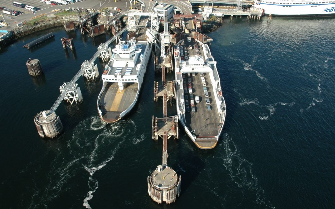
by CoastView | Oct 4, 2024 | 2024, British Columbia, Coastal Features, Communities, Developments, Embayments, Historical, Islands, Land Use
Swartz Bay is at the north end of the Saanich Peninsula on Vancouver Island and is the location of a BC Ferries terminal that provides the marine link connecting Highway 17 with the mainland, about 25 miles (40 km) southwest of Tsawwassen and 2.7 miles (4.3 km) north...
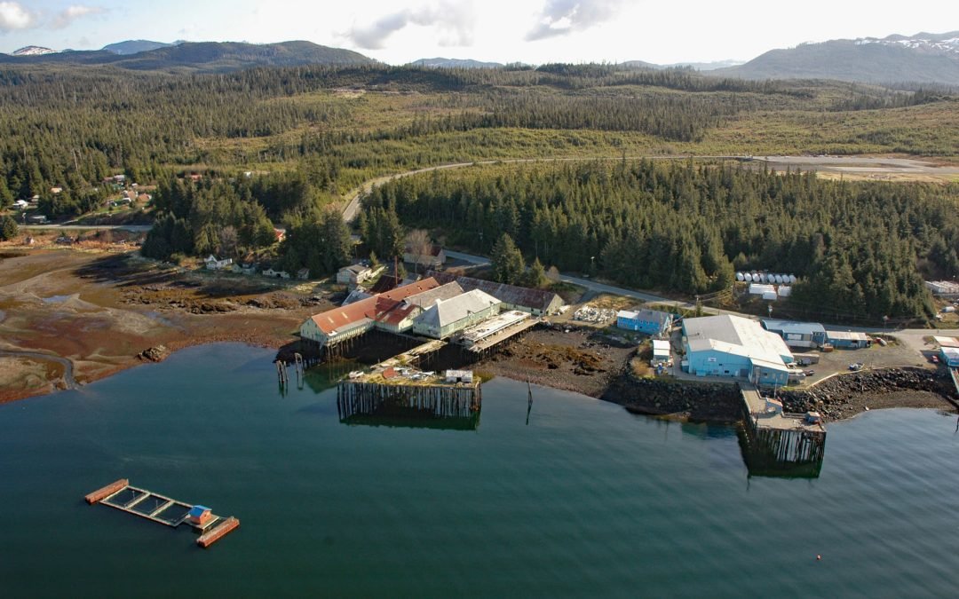
by CoastView | Oct 3, 2024 | 2024, Alaska, Canneries, Communities, Historical, Islands, Land Use
Kake is a Tlingit village on the northeastern shore of Keku Strait, on the northwest shore of Kupreanof Island in the Alexander Archipelago of Southeast Alaska, about 95 miles (153 km) south-southeast of Juneau and 39 miles (63 km) west-northwest of Peterburg, Alaska....