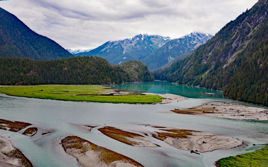
by CoastView | Jan 31, 2024 | 2024, British Columbia, Embayments, January 2024, Land Use, Natural History, Parks, Rivers
Kitlope River starts from the Kitimat Ranges and flows generally northwest to the head of Gardner Canal, about 125 miles (202 km) southeast of Prince Rupert and 75 miles (121 km) north of Bella Bella, British Columbia. The Kitlope Valley and the river are named for...
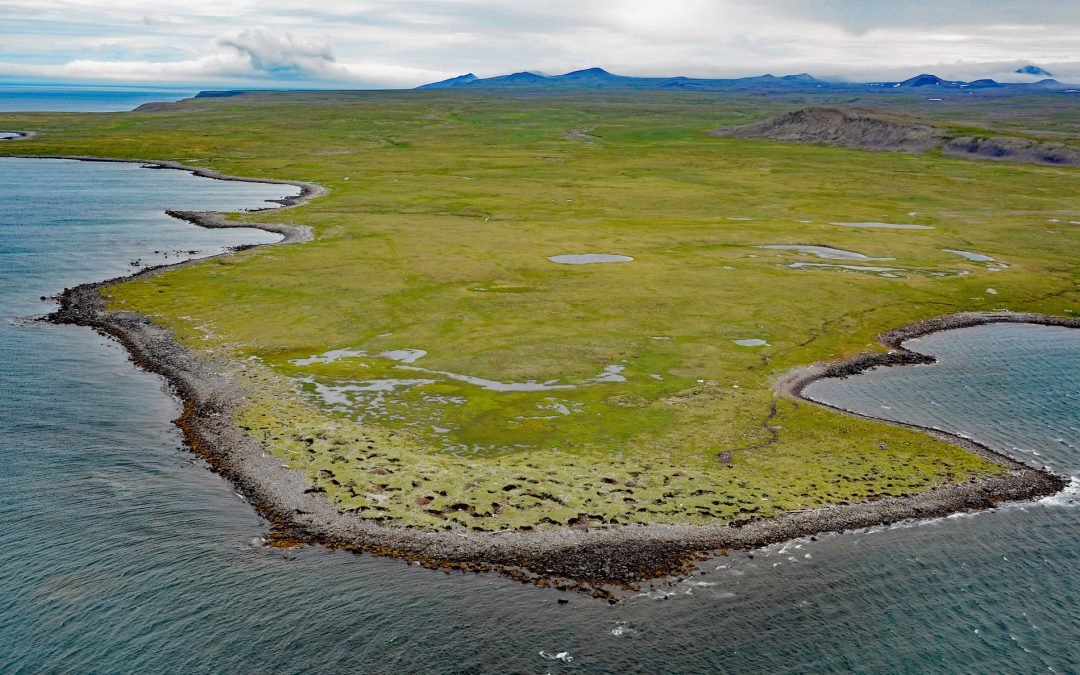
by CoastView | Jan 31, 2024 | 2024, Alaska, Coastal Features, Historical, Islands, January 2024, Land Use, Natural History, Shelter Cabins
Kookoolik is a historical community, also known as Kukulik, located on Cape Kookoolik on the northern coast of Saint Lawrence Island, about 160 miles (258 km) southwest of Nome and 4 miles (6.5 km) east of Savoonga, Alaska. Kookoolik was one of several Saint Lawrence...
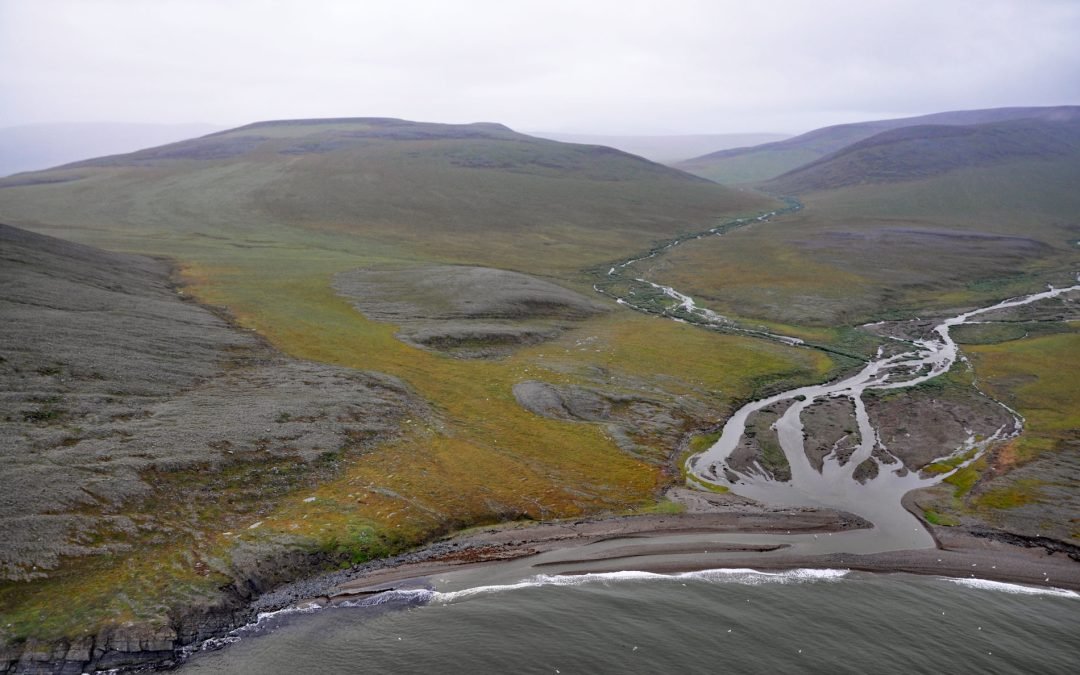
by CoastView | Jan 30, 2024 | 2024, Alaska, Beaches, Biodiversity, Communities, Headlands, Historical, January 2024, Land Use, Natural History
Kapaloak Creek starts from an elevation of roughly 1200 feet (366 m) in the Lisburne Hills and flows generally west for 8.5 miles (14 km) to Cape Dyer on the Chukchi Sea and the site of a historical Iñupiat village, about 110 miles (177 km) southwest of Point Lay and...
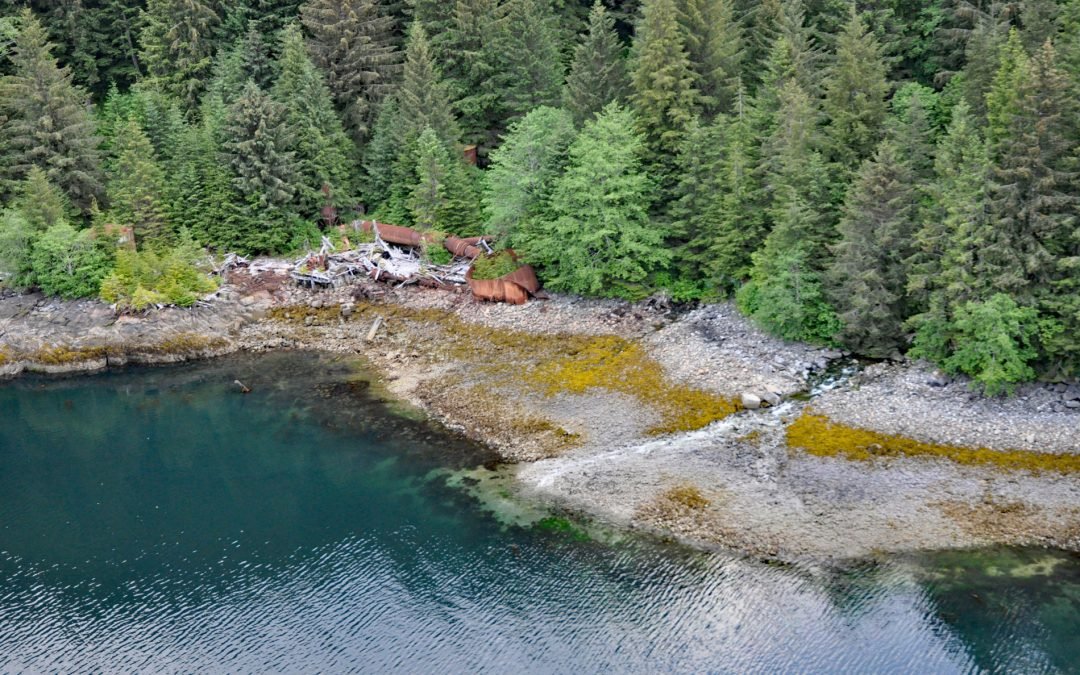
by CoastView | Jan 29, 2024 | 2024, Alaska, Biodiversity, Canneries, Coastal Features, Embayments, Islands, January 2024, Land Use, Natural History
Washington Bay trends east for 2 miles (3.2 km) on the northwest coast of Kuiu Island and is the site of a historical herring reduction facility near the head of the bay that is flanked by steep mountains rising abruptly to 2,800 feet (853 m) on the north and 2,200...
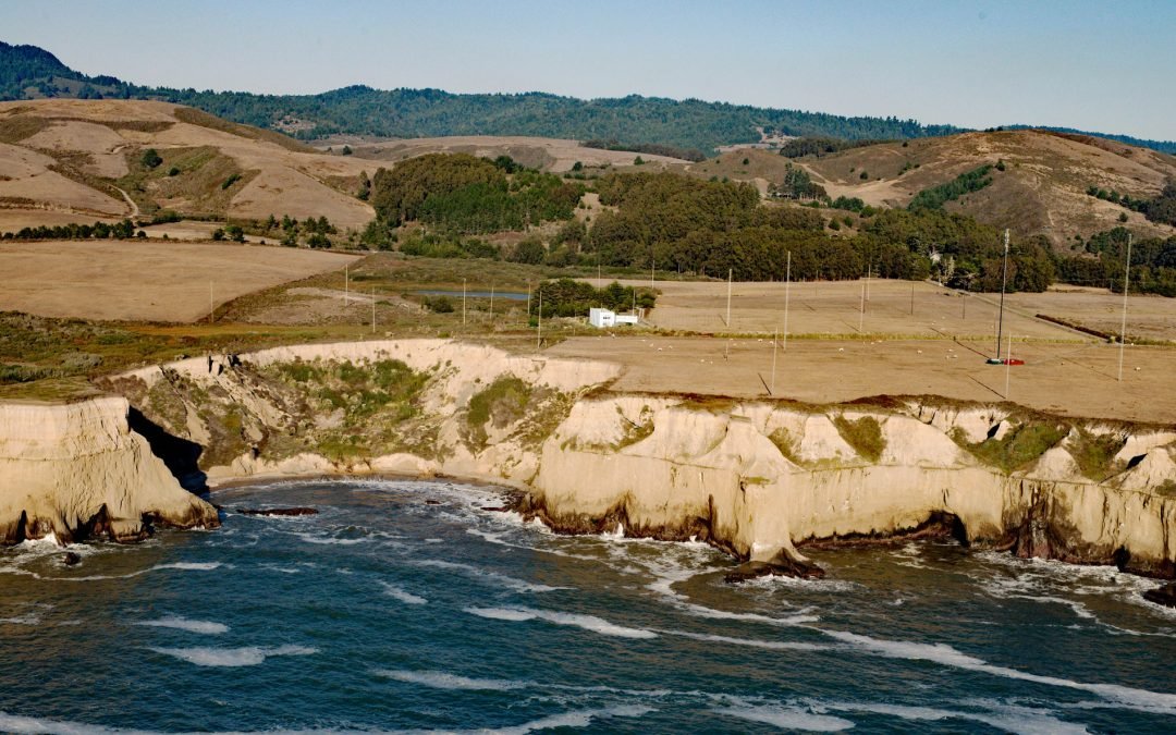
by CoastView | Jan 28, 2024 | 2024, California, Coastal Features, Developments, January 2024, Land Use
KFS WebSDR is co-located with the KFS Kiwi high-frequency radio receiver station near the mouth of Lobitos Creek, about 5.5 miles (9 km) south of Half Moon Bay and 0.8 miles (1.3 km) west of Lobitos, California. For many years this station provided continuous-wave...
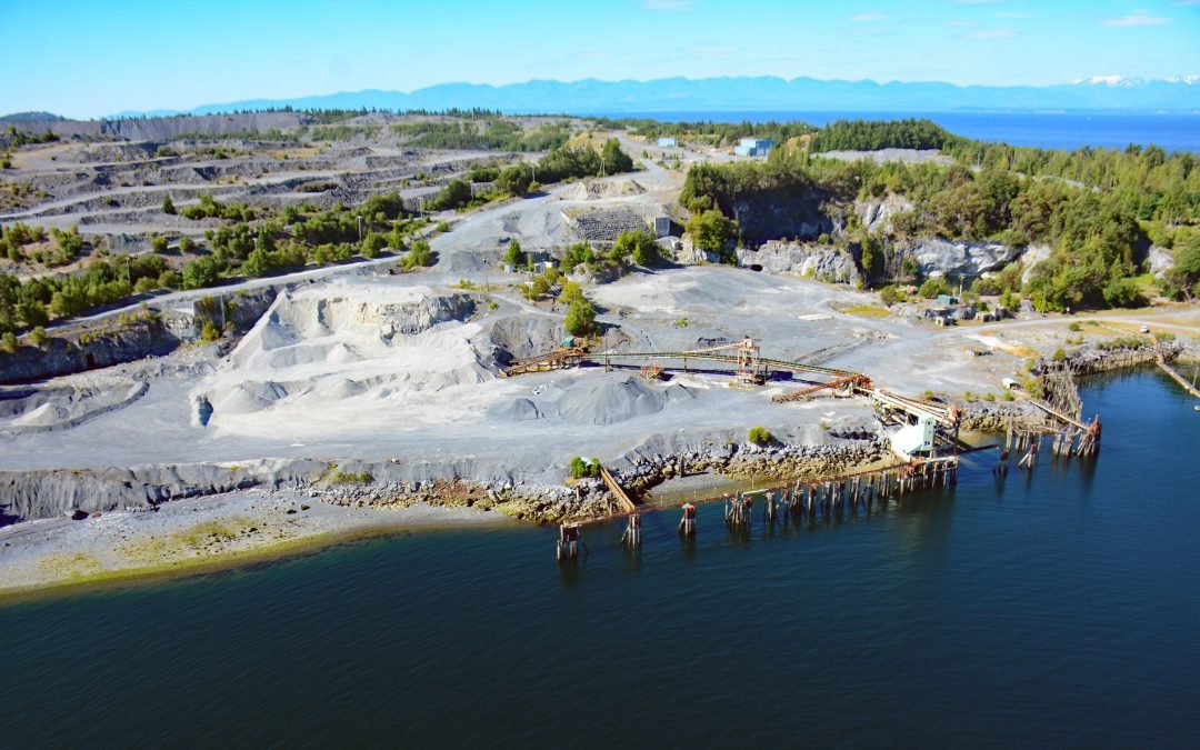
by CoastView | Jan 27, 2024 | 2024, Biodiversity, British Columbia, Coastal Features, Communities, Developments, Embayments, Islands, January 2024, Land Use, Mines, Natural History
Blubber Bay is a community and an embayment on the northern tip of Texada Island, between the Strait of Georgia to the west and Malaspina Strait to the east, and the site of a historical shore whaling station and present-day limestone mine, about 76 miles (122 km)...