by CoastView | Mar 23, 2024 | 2024, Beaches, Headlands, Land Use, Mines, Natural History, Parks, Washington
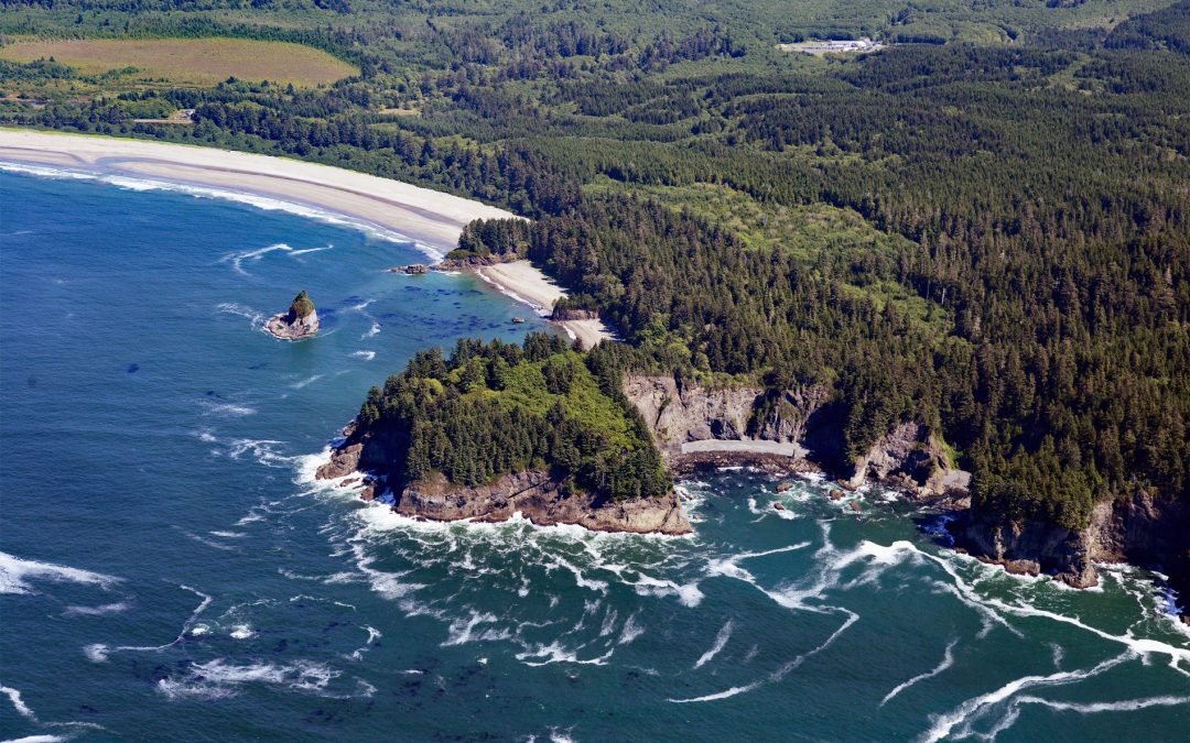
Portage Head is a prominent headland south of Cape Flattery on the Olympic Peninsula that separates Makah Bay Beach from Shi Shi Beach, about 58 miles (94 km) west-northwest of Port Angeles and 6 miles (10 km) southwest of Neah Bay, Washington. The headland is on the...
by CoastView | Mar 22, 2024 | 2024, Alaska, Beaches, Coastal Features, Developments, Historical, Islands, Land Use, Mines, Natural History
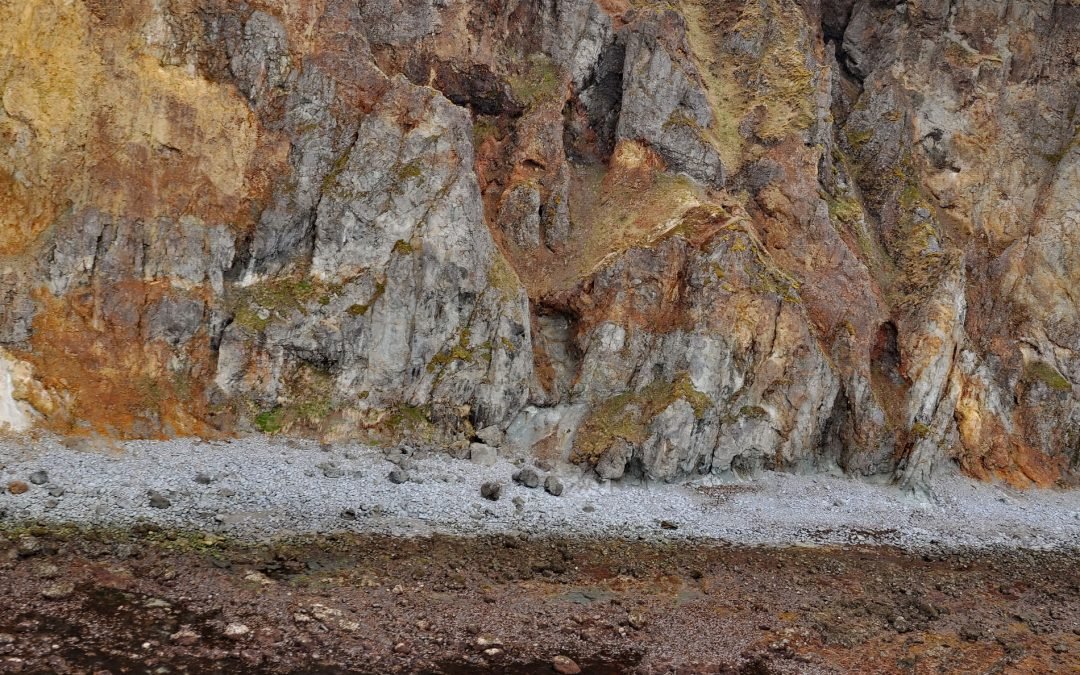
Vindicator is a historical beach placer mine in the Alaska Peninsula Mining District situated on the western shore of Popof Island between Sand Point to the north and Red Cove to the south, about 260 miles (419 km) northeast of Dutch Harbor and 67 miles (108 km)...
by CoastView | Mar 21, 2024 | 2024, Alaska, Biodiversity, Canneries, Coastal Features, Communities, Developments, Historical, Land Use, Natural History, Rivers
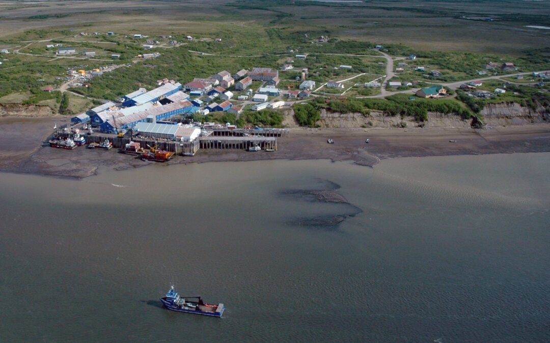
Diamond NN is a historic cannery in South Naknek at the mouth of the Naknek River that flows into Kvichak Bay, an arm of Bristol Bay, about 56 miles (90 km) southeast of Dillingham and 13 miles (21 km) west of King Salmon, Alaska. The salmon cannery was built by the...
by CoastView | Mar 20, 2024 | 2024, Alaska, Beaches, Climate Change, Coastal Features, Embayments, Glaciers, Land Use, Natural History, Parks
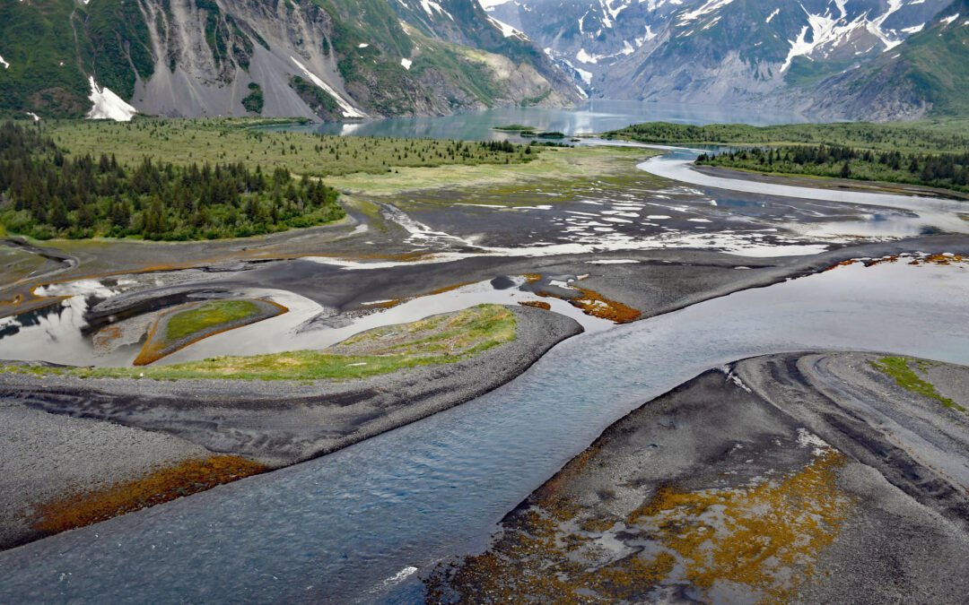
Pedersen Lagoon receives freshwater from proglacial lakes of the Addison and Pedersen glaciers that descend from the Harding Icefield in Kenai Fjords National Park on the western shore of Aialik Bay, about 64 miles (103 km) east-northeast of Homer and 19 miles (31 km)...
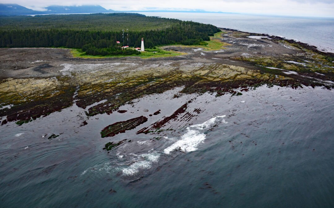
by CoastView | Mar 19, 2024 | 2024, British Columbia, Coastal Features, Developments, Headlands, Islands, Land Use, Lighthouses, Natural History, Parks
Estevan Point is the site of a historic lighthouse at the end of the Hesquiat Peninsula which forms the southern entrance to Nootka Sound on the west coast of Vancouver Island, about 35 miles (56 km) southwest of Gold River and 33 miles (53 km) northwest of Tofino,...
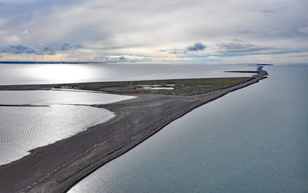
by CoastView | Mar 18, 2024 | 2024, Alaska, Beaches, Climate Change, Embayments, Islands, Natural History
Bodfish Island is part of the Jones Island barrier chain between Cottle Island to the east and Bertoncini Island to the west, separating Simpson Lagoon from the Beaufort Sea, about 178 miles (286 km) southeast of Utqiagvik and 30 miles (48 km) northwest of Deadhorse,...