by CoastView | Oct 11, 2023 | 2023, Alaska, Beaches, Biodiversity, Coastal Features, Embayments, Land Use, Mines, Natural History, Parks, Rivers
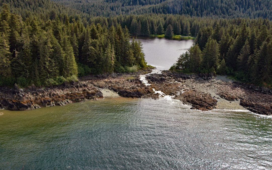
Peterson Lagoon is the estuary of Peterson Creek that starts from the outlet of Peterson Lake at an elevation of 734 feet (224 m) on Auke Mountain and flows north-northwest for 4 miles (7 km) to the lagoon that connects to Eagle Harbor, about 56 miles (90 km)...

by CoastView | Oct 10, 2023 | 2023, Alaska, Beaches, Biodiversity, Coastal Features, Land Use, Natural History, Parks, Rivers, Shelter Cabins
Rabbit Creek starts in the Mulgrave Hills and flows southwest for 23 miles (37 km) through the File Mountains, also known as the Tahinichok Mountains, to the Chukchi Sea at the southern end of Imik Lagoon in Cape Krusenstern National Monument, about 96 miles (155 km)...

by CoastView | Oct 8, 2023 | 2023, Alaska, Beaches, Coastal Features, Historical, Land Use, Natural History, Parks, Rivers, Shelter Cabins
Aitiligauraq Shelter Cabin is in the Cape Krusenstern National Monument in northwestern Alaska and is situated on the south bank of an unnamed creek that flows west for 5 miles (8 km) from Eigaloruk Mountain to a coastal lagoon, about 110 miles (177 km) southeast of...
by CoastView | Oct 6, 2023 | 2023, Alaska, Communities, Historical, Land Use, Mines, Rivers
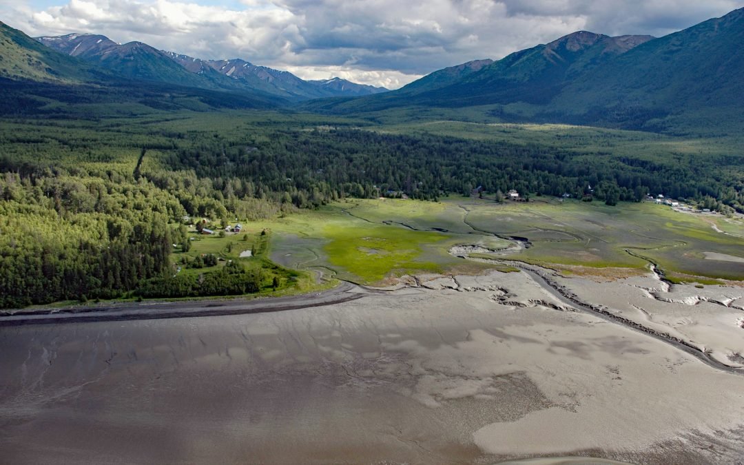
Hope is a historic community on the Kenai Peninsula at the mouth of Resurrection Creek on the south shore of Turnagain Arm in upper Cook Inlet, about 22 miles (35.5 km) southeast of Anchorage and 18 miles (29 km) west-southwest of Girdwood, Alaska. Resurrection Creek...
by CoastView | Oct 5, 2023 | 2023, Biodiversity, British Columbia, Embayments, Land Use, Natural History, Rivers
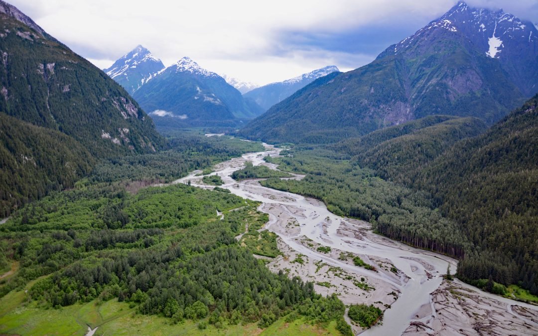
Kshwan River starts from the terminus of the retreating Kshwan Glacier in the Cambria Icefield and flows south for 10 miles (16 km) where it merges with the Sutton River and then continues for another 3 miles (5 km) to the head of Hastings Arm, about 95 miles (153 km)...
by CoastView | Oct 3, 2023 | 2023, Beaches, Biodiversity, Coastal Features, Communities, Natural History, Rivers, Washington
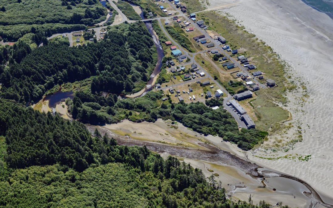
Moclips is a coastal community located between the south shore of the Moclips River and Mocrocks Beach. It is situated about 83 miles (134 km) west of Tacoma and 27 miles (44 km) northwest of Aberdeen, Washington. With its stunning natural surroundings and rich...