
by CoastView | Jan 28, 2024 | 2024, California, Coastal Features, Developments, Land Use
KFS WebSDR is co-located with the KFS Kiwi high-frequency radio receiver station near the mouth of Lobitos Creek, about 5.5 miles (9 km) south of Half Moon Bay and 0.8 miles (1.3 km) west of Lobitos, California. For many years this station provided continuous-wave...

by CoastView | Jan 27, 2024 | 2024, Biodiversity, British Columbia, Coastal Features, Communities, Developments, Embayments, Islands, Land Use, Mines, Natural History
Blubber Bay is a community and an embayment on the northern tip of Texada Island, between the Strait of Georgia to the west and Malaspina Strait to the east, and the site of a historical shore whaling station and present-day limestone mine, about 76 miles (122 km)...
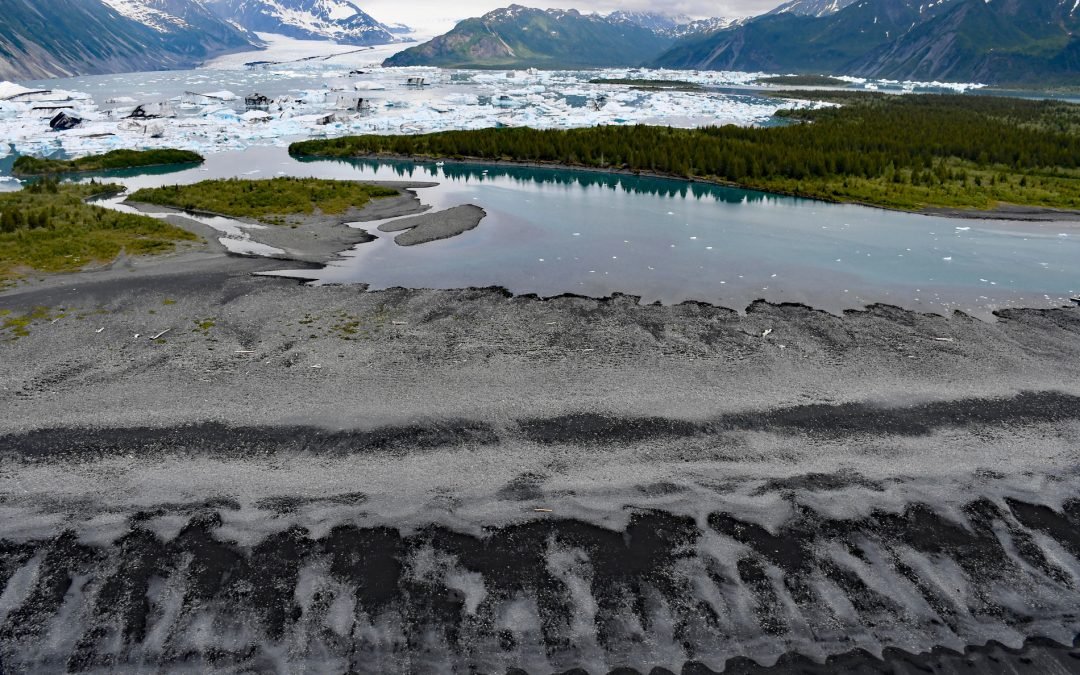
by CoastView | Jan 26, 2024 | 2024, Alaska, Beaches, Coastal Features, Embayments, Glaciers, Land Use, Natural History, Parks
Bear Glacier starts from an elevation of roughly 4,000 feet (1,219 m) on the eastern flank of the Harding Icefield in Kenai Fjords National Park and descends generally southeast for 17 miles (27 km) to a proglacial lake dammed by a terminal moraine between Bear...

by CoastView | Jan 25, 2024 | 2024, Alaska, Biodiversity, Coastal Features, Embayments, Historical, Land Use, Mines, Natural History, Parks
Kuliak Bay is about 4 miles (6.5 km) wide at the entrance on the western shore of Shelikof Strait and gradually tapers to the northwest for 5 miles (8 km) into Katmai National Park and Preserve on the Alaska Peninsula, about 92 miles (148 km) southeast of King Salmon...
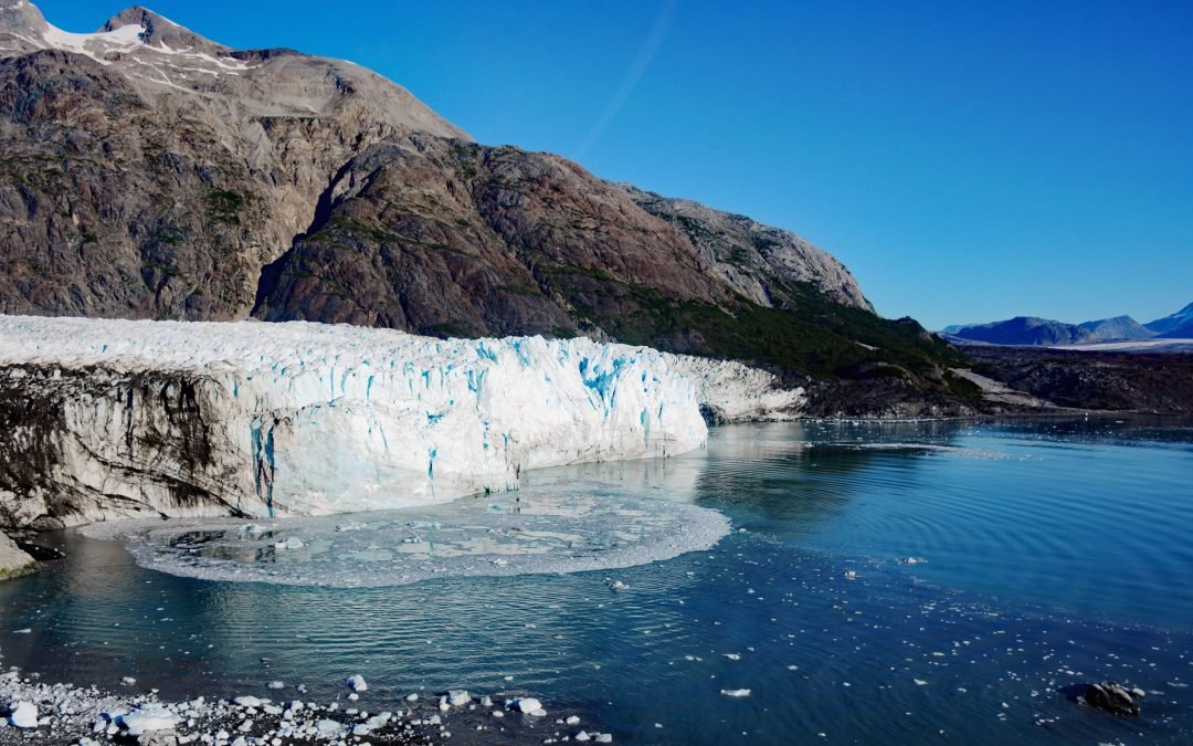
by CoastView | Jan 24, 2024 | 2024, Alaska, Biodiversity, Coastal Features, Embayments, Glaciers, Land Use, Natural History, Parks
Margerie Glacier starts at an elevation of 9,860 feet (3,005 m) on the international border of the United States and Canada between Mount Root to the north and Mount Fairweather to the south and flows generally east for 21 miles (34 km) to tidewater at Tarr Inlet in...
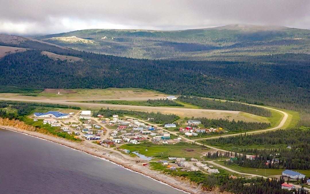
by CoastView | Jan 23, 2024 | 2024, Alaska, Beaches, Biodiversity, Coastal Features, Communities, Land Use, Natural History
Elim is a mixed Central Yup’ik and Iñupiaq community situated on the Iditarod Trail at the mouth of Elim Creek on the Seward Peninsula and the north shore of Norton Bay, about 39 miles (63 km) southwest of Koyuk and 24 miles (38 km) east-northeast of Golovin,...

by CoastView | Jan 22, 2024 | 2024, Alaska, Beaches, Biodiversity, Canneries, Communities, Embayments, Islands, Land Use, Natural History
Ikatan Peninsula is connected to the northeastern tip of Unimak Island by a sand spit or tombolo separating Ikatan Bay to the north from Otter Cove to the south and is the site of the historical community of Ikatan, about 143 miles (230 km) northeast of Unalaska and 8...
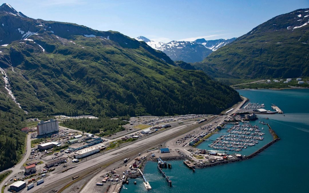
by CoastView | Jan 21, 2024 | 2024, Alaska, Coastal Features, Communities, Developments, Land Use, Natural History
Whittier is a community and marine terminal for the Alaska Railroad and cruise ships, situated on the alluvial fan of Whittier Creek on the south shore of Passage Canal, a deglaciated fjord in northwestern Prince William Sound, about 82 miles (132 km) west-southwest...

by CoastView | Jan 20, 2024 | 2024, Alaska, Beaches, Climate Change, Coastal Features, Communities, Developments, Land Use, Natural History
Kenai is a community situated at the site of Shk’ituk’t, a historical Dena’ina village located on the west coast of the Kenai Peninsula, on the eastern shore of Cook Inlet at the mouth of the Kenai River, about 65 miles (15 km) southwest of Anchorage...
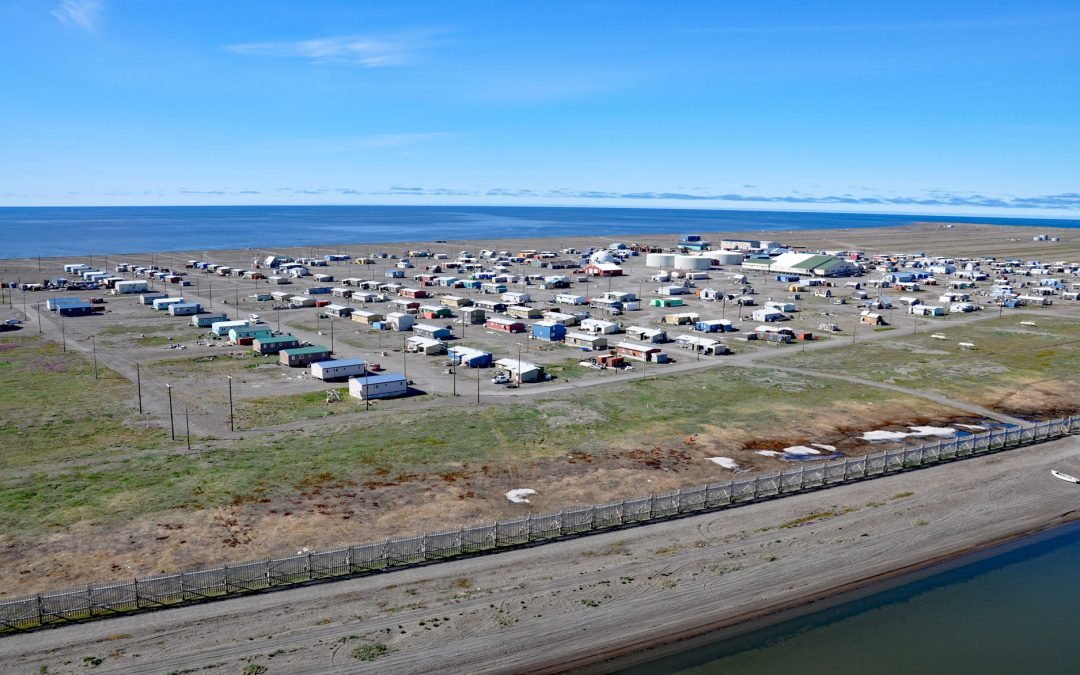
by CoastView | Jan 19, 2024 | 2024, Alaska, Beaches, Coastal Features, Communities, Embayments, Land Use, Natural History
Point Hope is an Iñupiaq whaling community also known as Tikiġaq or Tigara, situated on a barrier spit that extends northwest from Cape Thompson and joins another spit that extends southwest from the Lisburne Peninsula to enclose several lagoons including Marryat...